Country:
Region:
City:
Latitude and Longitude:
Time Zone:
Postal Code:
IP information under different IP Channel
ip-api
Country
Region
City
ASN
Time Zone
ISP
Blacklist
Proxy
Latitude
Longitude
Postal
Route
IPinfo
Country
Region
City
ASN
Time Zone
ISP
Blacklist
Proxy
Latitude
Longitude
Postal
Route
MaxMind
Country
Region
City
ASN
Time Zone
ISP
Blacklist
Proxy
Latitude
Longitude
Postal
Route
Luminati
Country
ASN
Time Zone
America/Chicago
Latitude
Longitude
Postal
db-ip
Country
Region
City
ASN
Time Zone
ISP
Blacklist
Proxy
Latitude
Longitude
Postal
Route
ipdata
Country
Region
City
ASN
Time Zone
ISP
Blacklist
Proxy
Latitude
Longitude
Postal
Route
Popular places and events near this IP address

Dewey Square Tunnel
Distance: Approx. 72 meters
Latitude and longitude: 42.34833333,-71.0575
The Dewey Square Tunnel in Boston, Massachusetts, is part of Interstate 93 (concurrent with US 1 and Route 3), running under the heart of the city's financial district, including Dewey Square. Built in 1959, it was part of Boston's Central Artery freeway construction project of the 1950s. Known to locals as the South Station Tunnel (due to its proximity to South Station), the Dewey Square Tunnel is of cut-and-cover design, and originally was six lanes wide (three in each direction), with no breakdown lanes.

Chinatown, Boston
Neighborhood of Boston in Suffolk, Massachusetts, United States
Distance: Approx. 300 meters
Latitude and longitude: 42.3501,-71.0601
Chinatown, Boston (Cantonese: 唐人街; Jyutping: Tong4jan4gaai1) is a neighborhood located in downtown Boston, Massachusetts, United States. It is the only surviving historic ethnic Chinese enclave in New England since the demise of the Chinatowns in Providence, Rhode Island and Portland, Maine after the 1950s. Because of the high population of Asians and Asian Americans living in this area of Boston, there is an abundance of Chinese and Vietnamese restaurants located in Chinatown.
Leather District
United States historic place
Distance: Approx. 205 meters
Latitude and longitude: 42.3506,-71.0574
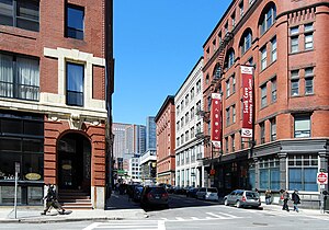
The Leather District is a neighborhood of Boston near South Street, between the Financial District and Chinatown. The Leather District (occasionally referred to as the "LD") is a tightly defined area bounded by Kneeland Street to the south, Essex Street to the north, Atlantic Avenue to the east and Lincoln Street to the west. It is so named due to the dominance of the leather industry in the late 19th century.

South Station Bus Terminal
Bus station in Boston, Massachusetts
Distance: Approx. 161 meters
Latitude and longitude: 42.35,-71.0558
The South Station Bus Terminal, owned by the Massachusetts Bay Transportation Authority, is the main gateway for long-distance coach buses in Boston, Massachusetts. It is located at 700 Atlantic Avenue, at the intersection with Beach Street, in the Chinatown/Leather District neighborhoods. The facility is immediately south-southwest of the main MBTA/Amtrak South Station terminal, and is located above the station platforms and tracks.

Font Bureau
American digital type foundry
Distance: Approx. 178 meters
Latitude and longitude: 42.35030556,-71.05763889
The Font Bureau, Inc. or Font Bureau is a digital type foundry based in Boston, Massachusetts, United States. The foundry is one of the leading designers of typefaces, specializing in type designs for magazine and newspaper publishers.
Green Restaurant Certification
Environmental certification
Distance: Approx. 342 meters
Latitude and longitude: 42.35184,-71.057489
The Green Restaurant Association (GRA) is a United States non-profit organization that provides certification for restaurants to become more environmentally responsible. Since 1990, the GRA has been building an extensive database of environmental goals for the restaurant industry. Green Restaurant Certification allows diners to be able to rely on their favorite restaurant's environmental claims and communicates credibility.
Gallery East
Distance: Approx. 287 meters
Latitude and longitude: 42.35136667,-71.05654722
Gallery East is an art and performance network based in Boston, Massachusetts notable for being one of the first venues to host hardcore punk rock shows for an all-ages audience. Founded in 1979 by Duane Lucia and Al Ford, it closed its location at 24 East St. in 1983, but re-emerged in 2006 as a driving force that continues to support up and coming artists and performers.
New England Legal Foundation
Legal advocacy organization
Distance: Approx. 278 meters
Latitude and longitude: 42.351,-71.0585
The New England Legal Foundation (NELF) is an American not-for-profit legal foundation. NELF states that it challenges intrusions by governments and special interest groups which would interfere with the economic freedoms of U.S. citizens and business enterprises in New England and the nation.
South Street Diner
Diner in Boston, United States
Distance: Approx. 124 meters
Latitude and longitude: 42.34977,-71.05763
South Street Diner, established in 1947, is a 24-hour, seven night a week diner in Boston's Leather District. It was named '2011 Best Diner' by Boston Magazine, along with 'The Best Late Night Food' in the US by Esquire. Thrillist named South Street Diner as one of the best 24-hour diners in the country.
Fort Point Channel tunnel
Distance: Approx. 270 meters
Latitude and longitude: 42.347,-71.0547
The Fort Point Channel Tunnel is a tunnel underneath the South Boston Streets and Fort Point Channel. It was built using a casting basin. It was built 1991–1994 in the Big Dig.

China Trade Gate
Paifang in Boston, Massachusetts, U.S.
Distance: Approx. 347 meters
Latitude and longitude: 42.35111111,-71.05972222
China Trade Gate is a paifang archway at the Beach Street entrance to the Chinatown neighborhood of Boston, Massachusetts, United States. It was designed by David Judelson and was originally donated to the city by the government of Taiwan in 1982.
O Ya (restaurant)
Japanese restaurant in Boston, Massachusetts, U.S.
Distance: Approx. 297 meters
Latitude and longitude: 42.35147222,-71.05691667
O Ya is a Japanese omakase-style restaurant in Boston, Massachusetts. The restaurant is owned by Tim and Nancy Cushman.
Weather in this IP's area
clear sky
19 Celsius
18 Celsius
16 Celsius
20 Celsius
1018 hPa
72 %
1018 hPa
1018 hPa
10000 meters
1.53 m/s
1.54 m/s
302 degree
05:32:08
20:09:06
