Country:
 USA
USARegion:
City:
Latitude and Longitude:
Time Zone:
Postal Code:
IP information under different IP Channel
ip-api
Country
Region
City
ASN
Time Zone
ISP
Blacklist
Proxy
Latitude
Longitude
Postal
Route
IPinfo
Country
Region
City
ASN
Time Zone
ISP
Blacklist
Proxy
Latitude
Longitude
Postal
Route
MaxMind
Country
Region
City
ASN
Time Zone
ISP
Blacklist
Proxy
Latitude
Longitude
Postal
Route
Luminati
Country
USASN
Time Zone
America/Chicago
ISP
RECNET-AS
Latitude
Longitude
Postal
db-ip
Country
Region
City
ASN
Time Zone
ISP
Blacklist
Proxy
Latitude
Longitude
Postal
Route
ipdata
Country
Region
City
ASN
Time Zone
ISP
Blacklist
Proxy
Latitude
Longitude
Postal
Route
Popular places and events near this IP address
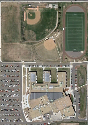
Lakewood High School (Colorado)
Public secondary school in Lakewood, Colorado, United States
Distance: Approx. 490 meters
Latitude and longitude: 39.72833333,-105.10638889
Lakewood High School is a public primary school located in Lakewood, Colorado, United States. It is part of Jefferson County Public Schools. Lakewood was ranked as the 111th best school in the nation by Newsweek in 2006, and as the 108th in 2008.
Colorado Christian University
Christian university in Lakewood, Colorado
Distance: Approx. 1815 meters
Latitude and longitude: 39.71275,-105.0945
Colorado Christian University (CCU) is a private Christian university in Lakewood, Colorado. CCU was founded by Clifton Fowler in 1914 as the Denver Bible Institute.
Denver Federal Center
Complex of United States federal agencies in Colorado, USA
Distance: Approx. 1150 meters
Latitude and longitude: 39.719632,-105.12105
The Denver Federal Center, in Lakewood, Colorado, is part of the General Services Administration and is home to about 6,200 employees of agencies of the federal government of the United States. The Center encompasses an area of about 670 acres (2.7 km2) and has 90 buildings with over 4,000,000 square feet (400,000 m2) of office, warehouse, lab and special use space. There are 28 different Federal agencies on-site, making it the largest concentration of Federal agencies outside of Washington, D.C. The major employers at the Center include the United States Department of the Interior (and its Bureau of Land Management, Bureau of Reclamation, and United States Geological Survey) and the General Services Administration.
Colorado School of Trades
Gunsmithing school in Colorado, United States
Distance: Approx. 1979 meters
Latitude and longitude: 39.74186,-105.10421
The Colorado School of Trades is a private for-profit school in Lakewood, Colorado that focuses exclusively on gunsmithing. Graduates receive an Associate Degree. It was founded in 1947.

National Science Foundation Ice Core Facility
US storage site for frozen water samples
Distance: Approx. 1848 meters
Latitude and longitude: 39.71376,-105.12566
The National Science Foundation Ice Core Facility (NSF-ICF), known as the National Ice Core Laboratory (NICL) before 2018, is the primary repository for ice cores collected by the United States. The facility is located at the Denver Federal Center in Lakewood, Colorado, and is managed by the United States Geological Survey (USGS). Funding for the facility comes from the National Science Foundation Office of Polar Programs, while scientific research is managed by the University of New Hampshire.

St. Anthony Hospital (Colorado)
Hospital in Colorado, United States
Distance: Approx. 1935 meters
Latitude and longitude: 39.7164,-105.1292
St. Anthony Hospital, previously known as St. Anthony Central Hospital, is one of six Level I Trauma Centers in Colorado.

Lakewood, Colorado
City in Colorado, United States
Distance: Approx. 2306 meters
Latitude and longitude: 39.70472222,-105.11722222
Lakewood is the home rule municipality that is the most populous municipality in Jefferson County, Colorado, United States. The city population was 155,984 at the 2020 U.S. Census, making Lakewood the fifth most populous city in Colorado and the 167th most populous city in the United States. Lakewood is a suburb of Denver and is a principal city of the Denver–Aurora–Lakewood, CO Metropolitan Statistical Area and a major city of the Front Range Urban Corridor.

Denver Museum of Miniatures, Dolls and Toys
Toy museum in Lakewood, Colorado
Distance: Approx. 629 meters
Latitude and longitude: 39.73015,-105.10908889
The Denver Museum of Miniatures, Dolls and Toys is a private, non-profit museum that is located in Lakewood, Colorado. The museum was founded in 1981. In 1987, the museum opened at its first location in cooperation with the Colorado Historical Society within the Pearce-McAllister Cottage.

Jefferson County Public Library
Public library in Colorado, United States
Distance: Approx. 2540 meters
Latitude and longitude: 39.74707,-105.11358
Jefferson County Public Library (JCPL) serves Jefferson County, Colorado, United States, and is the third largest public library in the state. Its service area spans from the foothills of Colorado's Rocky Mountains to the edge of the metro Denver area. It serves a diverse set of Colorado communities, from Lakewood, (pop.

Federal Center station (RTD)
Light rail station in Lakewood, Colorado
Distance: Approx. 1768 meters
Latitude and longitude: 39.72,-105.129
Federal Center is an at-grade light rail station on the W Line of the RTD Rail system. It is located near the intersection of West 2nd Place and Routt Street, on the grounds of the Denver Federal Center, after which the station is named, in Lakewood, Colorado. The station opened on April 26, 2013, on the West Corridor, built as part of the Regional Transportation District (RTD) FasTracks public transportation expansion plan and voter-approved sales tax increase for the Denver metropolitan area.

Oak station (RTD)
Light rail station in Lakewood, Colorado
Distance: Approx. 1694 meters
Latitude and longitude: 39.7373,-105.1199
Oak is an at-grade light rail station on the W Line of the RTD Rail system. It is located near the intersection of West Colfax Avenue and Oak Street, after which the station is named, in Lakewood, Colorado. The station is located within the Lakewood Industrial Park.

Garrison station (RTD)
Light rail station in Lakewood, Colorado
Distance: Approx. 1582 meters
Latitude and longitude: 39.7366,-105.0995
Garrison is an at-grade light rail station on the W Line of the RTD Rail system. It is located near the intersection of West 13th Avenue and Garrison Street, after which the station is named, in Lakewood, Colorado. The station opened on April 26, 2013, on the West Corridor, built as part of the Regional Transportation District (RTD) FasTracks public transportation expansion plan and voter-approved sales tax increase for the Denver metropolitan area.
Weather in this IP's area
few clouds
17 Celsius
16 Celsius
15 Celsius
19 Celsius
1010 hPa
74 %
1010 hPa
832 hPa
10000 meters
2.59 m/s
3.23 m/s
246 degree
12 %
05:55:21
20:18:17