Country:
 Great Britain
Region:
City:
Latitude and Longitude:
Time Zone:
Postal Code:
IP information under different IP Channel
ip-api
Country
Region
City
ASN
Time Zone
ISP
Blacklist
Proxy
Latitude
Longitude
Postal
Route
IPinfo
Country
Region
City
ASN
Time Zone
ISP
Blacklist
Proxy
Latitude
Longitude
Postal
Route
MaxMind
Country
Region
City
ASN
Time Zone
ISP
Blacklist
Proxy
Latitude
Longitude
Postal
Route
Luminati
Country
GBASN
Time Zone
Europe/London
Latitude
Longitude
Postal
db-ip
Country
Region
City
ASN
Time Zone
ISP
Blacklist
Proxy
Latitude
Longitude
Postal
Route
ipdata
Country
Region
City
ASN
Time Zone
ISP
Blacklist
Proxy
Latitude
Longitude
Postal
Route
Popular places and events near this IP address

Uxbridge tube station
London Underground station
Distance: Approx. 96 meters
Latitude and longitude: 51.5459,-0.4783
Uxbridge is a London Underground station in Uxbridge in the London Borough of Hillingdon, West London. The station is the terminus of the Uxbridge branches of both the Metropolitan line and the Piccadilly line. The next station towards London is Hillingdon.

Uxbridge Vine Street railway station
Former railway station in England
Distance: Approx. 203 meters
Latitude and longitude: 51.5444,-0.4791
Uxbridge Vine Street station opened on 8 September 1856 as Uxbridge Station and was the earliest of three railway stations in Uxbridge, London.
Uxbridge High Street railway station
Former railway station in England
Distance: Approx. 533 meters
Latitude and longitude: 51.5504,-0.4833
Uxbridge High Street railway station in Uxbridge, England, was on what is now Oxford Road near its junction with Sanderson Road. It was the southern terminus and only station on the Great Western Railway (GWR) branch line from the GWR/GCR joint line, which is now the Chiltern Main Line.

Crown and Treaty
Pub in Uxbridge, London
Distance: Approx. 516 meters
Latitude and longitude: 51.5499,-0.4841
The Crown and Treaty is a pub on Oxford Road in Uxbridge, London, England, where Charles I and his Parliamentary opponents during the English Civil War held negotiations (the Treaty of Uxbridge) between 30 January and 22 February 1645. It is a Grade II* listed building, dating from 1576.

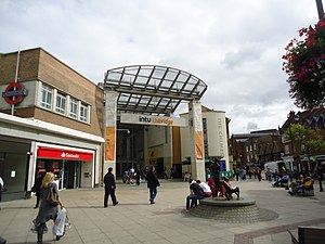
The Pavilions
Shopping mall in Uxbridge, England
Distance: Approx. 109 meters
Latitude and longitude: 51.5465,-0.4811
The Pavilions is an indoor shopping centre in Uxbridge, Greater London, England. It was opened in 1973 and refurbished in 1985 and has previously been known as the Pavilions Shopping Centre and before that, The Cedars Shopping Centre. Between 2005 and 2013, the centre was known as The Mall Pavilions while under the ownership of The Mall Fund.
RAF Hospital Uxbridge
Former Royal Air Force hospital in London, England
Distance: Approx. 570 meters
Latitude and longitude: 51.54583333,-0.47138889
RAF Hospital Uxbridge was a military hospital within the Royal Air Force station RAF Uxbridge.
The Chimes, Uxbridge
Shopping mall in Greater London, England
Distance: Approx. 280 meters
Latitude and longitude: 51.54611111,-0.47555556
The Chimes is a shopping centre in Uxbridge, within the London Borough of Hillingdon, owned by the Malaysian pension fund Kumpulan Persaan. Opened in February 2001, the centre includes 71 stores, cafes and restaurants, including Boots, H&M and Next as anchor stores. A multi-screen Odeon cinema with an IMAX screen is also part of the centre.

Queen's Head, Uxbridge
Pub in Uxbridge, London
Distance: Approx. 45 meters
Latitude and longitude: 51.54587,-0.47998
The Queen's Head is a public house at 54 Windsor Street, Uxbridge, London. The Grade II listed building is constructed of brick and dates from the early-mid 19th century.

Three Tuns, Uxbridge
Pub in Uxbridge, London
Distance: Approx. 87 meters
Latitude and longitude: 51.54556,-0.47889
The Three Tuns is a Grade II listed public house at 24 High Street, Uxbridge, London. It was built in the 16th and 17th centuries.

Randalls of Uxbridge
Former department store in Uxbridge, London
Distance: Approx. 217 meters
Latitude and longitude: 51.544628,-0.477739
Randalls of Uxbridge was a family-owned British department store in Vine Street, Uxbridge, which operated for 123 years until it closed in January 2015. The store mainly sold homeware and furniture, but also sold designer menswear.

Regal Cinema, Uxbridge
Former cinema in Uxbridge, Hillingdon, London, now a nightclub
Distance: Approx. 409 meters
Latitude and longitude: 51.544556,-0.474324
The Regal Cinema is a former cinema building in an Egyptian Revival architectural style in High Street, Uxbridge, in the London Borough of Hillingdon. It became the ABC Regal, then Discothèque Royale, and is now a branch of the Liquid nightclub chain. It is a Grade II* listed building, built in 1930–31 for Uxbridge Entertainments Ltd (a company controlled by the cinema speculator A. E. Abrahams), and the architect was E. Norman Bailey.

Hillingdon Civic Centre
Municipal building in London, England
Distance: Approx. 353 meters
Latitude and longitude: 51.5439,-0.4761
Hillingdon Civic Centre is a municipal building in the High Street, Uxbridge. The civic centre, which is the headquarters of Hillingdon London Borough Council, is a Grade II listed building.
Weather in this IP's area
broken clouds
13 Celsius
13 Celsius
12 Celsius
14 Celsius
1014 hPa
90 %
1014 hPa
1008 hPa
10000 meters
1.54 m/s
240 degree
75 %
05:18:29
20:58:07