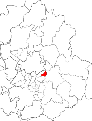
Country:
Region:
City:
Latitude and Longitude:
Time Zone:
Postal Code:
IP information under different IP Channel
ip-api
Country
Region
City
ASN
Time Zone
ISP
Blacklist
Proxy
Latitude
Longitude
Postal
Route
IPinfo
Country
Region
City
ASN
Time Zone
ISP
Blacklist
Proxy
Latitude
Longitude
Postal
Route
MaxMind
Country
Region
City
ASN
Time Zone
ISP
Blacklist
Proxy
Latitude
Longitude
Postal
Route
Luminati
Country
ASN
Time Zone
Asia/Seoul
ISP
Korea Telecom
Latitude
Longitude
Postal
db-ip
Country
Region
City
ASN
Time Zone
ISP
Blacklist
Proxy
Latitude
Longitude
Postal
Route
ipdata
Country
Region
City
ASN
Time Zone
ISP
Blacklist
Proxy
Latitude
Longitude
Postal
Route
Popular places and events near this IP address

Seongnam
City in Gyeonggi, South Korea
Distance: Approx. 2500 meters
Latitude and longitude: 37.43333333,127.15
Seongnam (Korean pronunciation: [ˈsʰʌŋ.nam]) is the fourth largest city in South Korea's Gyeonggi Province after Suwon and the 10th largest city in the country. Its population is approximately one million. Seongnam is a satellite city of Seoul.
Tancheon Sports Complex
Distance: Approx. 1256 meters
Latitude and longitude: 37.410153,127.121322
Tancheon Sports Complex (Korean: 탄천종합운동장) is a group of sports facilities in Seongnam, South Korea. Its name was Seongnam 2 Sports Complex but changed to Tancheon Sports Complex in January 2006, naming after Tancheon. The complex consists of the Tancheon Stadium, Tancheon Baseball Stadium and a Sports Club.
Yatap station
Metro station in Seongnam, South Korea
Distance: Approx. 1056 meters
Latitude and longitude: 37.411244,127.128682
Yatap Station (Korean: 야탑역) is a station on the Suin–Bundang Line between Moran and Imae. Around the station, there are two big shopping malls: Kim's Club and Homeplus. Also, Yatap CGV Multiplex and Seongnam Bus Terminal are near the station.
Imae-dong
Neighborhood in Seongnam, South Korea
Distance: Approx. 2367 meters
Latitude and longitude: 37.4,127.13333333
Imae-dong (Korean: 이매동; Hanja: 二梅洞) is a Bundang neighborhood in the city of Seongnam, Gyeonggi Province. It is officially divided into Imae-1-dong and Imae-2-dong. It shares its name with a station on the Bundang Line.
Seongnam Arts Center
Concert hall in Seongnam, South Korea
Distance: Approx. 2012 meters
Latitude and longitude: 37.40289,127.131237
The Seongnam Arts Center (성남아트센터) is the largest venue for cultural events in the city of Seongnam. It is in Yatap-dong in Bundang, within a few minutes' walk of Imae Station. And it is situated near the Taewon High school.
Seongnam Sports Complex
Sports venue in Seongnam, South Korea
Distance: Approx. 1693 meters
Latitude and longitude: 37.433095,127.137614
Seongnam Sports Complex (Korean: 성남종합운동장) is a group of sports facilities in Seongnam, South Korea. The complex consists of the Seongnam Stadium, Field hockey field, and Indoor Arena.
Sangmu Gymnasium
Distance: Approx. 1668 meters
Latitude and longitude: 37.43122,127.140013
Sangmu Gymnasium is an indoor sporting arena located in Seongnam, South Korea. The capacity of the arena is 5,000 people and was built in 1986 to host wrestling events at the 1988 Summer Olympics.

Taepyeong station
Metro station in Seongnam, South Korea
Distance: Approx. 2101 meters
Latitude and longitude: 37.43944444,127.12805556
Taepyeong Station is a station on the Suin–Bundang Line between Gachon University and Moran Station. Located in central Seongnam, it is also in proximity of the Tancheon and Seoul Air Base.

Moran station
Metro station in Seongnam, South Korea
Distance: Approx. 1230 meters
Latitude and longitude: 37.43138889,127.12972222
Moran Station serves as the southern terminal of Seoul Subway Line 8 and is also a stop on the Suin–Bundang Line. The Moran Market is held near the station during the 4th and 9th days of the month.
Jungwon-gu
Non-autonomous District in Sudogwon, South Korea
Distance: Approx. 1427 meters
Latitude and longitude: 37.430392,127.137124
Jungwon-gu (Korean: 중원구) is a district (gu), in Seongnam, Gyeonggi Province, South Korea.

Sujin station
Metro station in Seongnam, South Korea
Distance: Approx. 2258 meters
Latitude and longitude: 37.4375,127.14083333
Sujin Station is a railway station on Seoul Subway Line 8.
Pangyo Techno Valley vent collapse
Distance: Approx. 2739 meters
Latitude and longitude: 37.401849,127.106645
Pangyo Techno Valley Vents Collapse was an accident in Pangyo Techno Valley, South Korea on 17 October 2014, when spectators at a nearby concert fell to their deaths when a underground car park ventilation cover collapsed. Approximately 700 people were in the park to watch the band 4minute perform.
Weather in this IP's area
overcast clouds
29 Celsius
36 Celsius
28 Celsius
32 Celsius
1014 hPa
80 %
1014 hPa
1011 hPa
7055 meters
3.2 m/s
6.23 m/s
194 degree
99 %
05:31:29
19:44:16


