Country:
 Chinese mainland
Region:
City:
Latitude and Longitude:
Time Zone:
Postal Code:
IP information under different IP Channel
ip-api
Country
Region
City
ASN
Time Zone
ISP
Blacklist
Proxy
Latitude
Longitude
Postal
Route
IPinfo
Country
Region
City
ASN
Time Zone
ISP
Blacklist
Proxy
Latitude
Longitude
Postal
Route
MaxMind
Country
Region
City
ASN
Time Zone
ISP
Blacklist
Proxy
Latitude
Longitude
Postal
Route
Luminati
Country
CNASN
Time Zone
Asia/Shanghai
ISP
CHINA UNICOM China169 Backbone
Latitude
Longitude
Postal
db-ip
Country
Region
City
ASN
Time Zone
ISP
Blacklist
Proxy
Latitude
Longitude
Postal
Route
ipdata
Country
Region
City
ASN
Time Zone
ISP
Blacklist
Proxy
Latitude
Longitude
Postal
Route
Popular places and events near this IP address

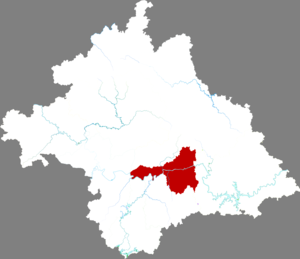
Nanning
Prefecture-level city in Guangxi, China
Distance: Approx. 1108 meters
Latitude and longitude: 22.8167,108.3275
Nanning is the capital and largest city by population of the Guangxi Zhuang Autonomous Region in Southern China. It is known as the "Green City (绿城) " because of its abundance of lush subtropical foliage. Located in the South of Guangxi, Nanning is surrounded by a hilly basin, with a warm, monsoon-influenced humid subtropical climate.
Guangxi University
Provincial public university in Nanning, Guangxi, China
Distance: Approx. 4126 meters
Latitude and longitude: 22.8389,108.2845
Guangxi University (广西大学) is a provincial public university in Nanning, Guangxi, China. It is affiliated with the Guangxi Zhuang Autonomous Region and co-funded by the regional government and the Ministry of Education. The university is part of Project 211 and the Double First-Class Construction.

Diwang International Commerce Center
Skyscraper in Nanning, Guangxi, China
Distance: Approx. 5015 meters
Latitude and longitude: 22.81805556,108.36555556
Diwang International Commerce Center (simplified Chinese: 地王国际商会中心; traditional Chinese: 地王國際商會中心; pinyin: Dìwáng Guójì Shānghuì Zhōngxīn) is a 54-floor 276 meter (906 foot) tall skyscraper completed in 2006 located in Nanning, China.
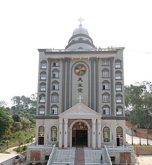
Roman Catholic Archdiocese of Nanning
Roman Catholic archdiocese in China
Distance: Approx. 4000 meters
Latitude and longitude: 22.8468,108.338
The Roman Catholic Archdiocese of Nanning (Latin: Nannimen(sis), Chinese: 南寧) is an archdiocese located in the city of Nanning (Guangxi) in China.
Qingxiu, Nanning
District in Guangxi, China
Distance: Approx. 3095 meters
Latitude and longitude: 22.8149,108.3468
Qingxiu District (simplified Chinese: 青秀区; traditional Chinese: 青秀區; pinyin: Qīngxiù Qū; Jyutping: cing1 sau3 keoi1; Standard Zhuang: Cinghsiu Gih) is the county seat and one of 7 districts of the prefecture-level city of Nanning, the capital of Guangxi Zhuang Autonomous Region, South China. It is Xincheng District (新城区) approved to rename to the present name by the Chinese State Council on September 15, 2004.

Xingning, Nanning
District in Guangxi, China
Distance: Approx. 268 meters
Latitude and longitude: 22.816,108.3192
Xingning District (simplified Chinese: 兴宁区; traditional Chinese: 興寧區; pinyin: Xīngníng Qū; Zhuang: Hinghningz Gih) is one of 7 districts of the prefecture-level city of Nanning, the capital of Guangxi Zhuang Autonomous Region, South China.

Xixiangtang, Nanning
District in Guangxi, China
Distance: Approx. 2771 meters
Latitude and longitude: 22.8403,108.3081
Xixiangtang District (simplified Chinese: 西乡塘区; traditional Chinese: 西鄉塘區; pinyin: Xīxiāngtáng Qū; Standard Zhuang: Sihsienghdangz Gih) is one of 7 districts of the prefecture-level city of Nanning, the capital of Guangxi Zhuang Autonomous Region, South China. The district was approved to establish by merging the former two districts of Yongxin (永新区, excluding 10 villages of Jaingxi Town) and Chengbei (城北区) by the Chinese State Council on September 15, 2004.

Jiangnan, Nanning
District in Guangxi, China
Distance: Approx. 4371 meters
Latitude and longitude: 22.8005,108.2779
Jiangnan District (simplified Chinese: 江南区; traditional Chinese: 江南區; pinyin: Jiāngnán Qū; Standard Zhuang: Gyanghnanz Gih) is one of seven districts of the prefecture-level city of Nanning, the capital of Guangxi Zhuang Autonomous Region, South China.
Nanning No.3 High School
Public school
Distance: Approx. 4127 meters
Latitude and longitude: 22.80388889,108.35444444
Nanning No.3 High School is a premier high school located in Nanning, Guangxi, China.
People's Hospital of Guangxi Zhuang Autonomous Region
Hospital in Guangxi Zhuang Autonomous Region, China
Distance: Approx. 1850 meters
Latitude and longitude: 22.803965,108.328281
The People's Hospital of Guangxi Zhuang Autonomous Region (Chinese: 广西壮族自治区人民医院) is a large, comprehensive provincial 3A hospital and medical center of Guangxi Zhuang Autonomous Region, China, established in 1941. As a teaching hospital, it facilitates final year medical students from Guangxi Medical University, Guilin Medical University.

People's Park (Nanning)
Urban public park in Nanning, Guangxi Zhuang Autonomous Region, China
Distance: Approx. 1842 meters
Latitude and longitude: 22.82722222,108.33055556
People's Park (Chinese: 人民公园; pinyin: Rénmín Gōngyuán) is an urban public park in central Nanning, the capital of Guangxi Zhuang Autonomous Region in southern China. It is also known as White Dragon Park (Chinese: 白龙公园; pinyin: Báilóng Gōngyuán) because of the White Dragon Lake inside the park.
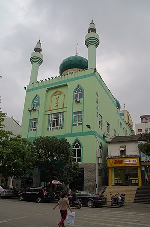
Nanning Mosque
Mosque in Nanning, Guangxi, China
Distance: Approx. 286 meters
Latitude and longitude: 22.81779,108.31418
The Nanning Mosque (simplified Chinese: 南宁清真寺; traditional Chinese: 南寧清真寺; pinyin: Nánníng Qīngzhēnsì) is a mosque in Xingning District, Nanning City, Guangxi, China.
Weather in this IP's area
overcast clouds
31 Celsius
38 Celsius
31 Celsius
31 Celsius
1000 hPa
81 %
1000 hPa
990 hPa
10000 meters
0.5 m/s
0.76 m/s
205 degree
100 %
06:15:36
19:30:38