Country:
Region:
City:
Latitude and Longitude:
Time Zone:
Postal Code:
IP information under different IP Channel
ip-api
Country
Region
City
ASN
Time Zone
ISP
Blacklist
Proxy
Latitude
Longitude
Postal
Route
IPinfo
Country
Region
City
ASN
Time Zone
ISP
Blacklist
Proxy
Latitude
Longitude
Postal
Route
MaxMind
Country
Region
City
ASN
Time Zone
ISP
Blacklist
Proxy
Latitude
Longitude
Postal
Route
Luminati
Country
ASN
Time Zone
Europe/Rome
ISP
Telecom Italia
Latitude
Longitude
Postal
db-ip
Country
Region
City
ASN
Time Zone
ISP
Blacklist
Proxy
Latitude
Longitude
Postal
Route
ipdata
Country
Region
City
ASN
Time Zone
ISP
Blacklist
Proxy
Latitude
Longitude
Postal
Route
Popular places and events near this IP address

Grison Alps
Distance: Approx. 5267 meters
Latitude and longitude: 46,9
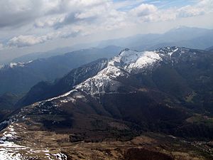
The Grison Alps are the mountains of the Graubünden canton of Switzerland (Grisons being the English name for the Graubünden region). There are many significant peaks in the Grison Alps, including the Tödi (3,614 m) and the highest peak, Piz Bernina (4,049 m). Many of the mountain ranges feature extensive glaciers, such as at the Adula, the Albula, the Silvretta, the Bernnina or the Rätikon range.

Claino con Osteno
Comune in Lombardy, Italy
Distance: Approx. 3855 meters
Latitude and longitude: 46,9.08333333
Claino con Osteno (Comasco: Scin Osten [ˌʃĩː uˈstẽː]) is a comune (municipality) in the Province of Como in the Italian region of Lombardy, located about 60 kilometres (37 mi) north of Milan and about 20 kilometres (12 mi) north of Como. It is a small comune on Lake Lugano, composed of a series of small frazioni (hamlets): the biggest ones (Claino and Osteno) have been chosen for the municipal name. Claino con Osteno borders the following municipalities: Alta Valle Intelvi, Laino, Ponna, Porlezza, Valsolda.
Pellio Intelvi
Frazione in Lombardy, Italy
Distance: Approx. 5092 meters
Latitude and longitude: 45.98333333,9.06666667
Pellio Intelvi was a comune (municipality) in the Province of Como in the Italian region Lombardy, located about 60 kilometres (37 mi) north of Milan and about 20 kilometres (12 mi) north of Como, on the border with Switzerland. It is divided in two distinct centers, Pellio Inferiore (or Pelsotto) and Pellio Superiore (Pelsopra). It has been a frazione of Alta Valle Intelvi since 2017.

Ramponio Verna
Frazione in Lombardy, Italy
Distance: Approx. 5092 meters
Latitude and longitude: 45.98333333,9.06666667
Ramponio Verna was a comune (municipality) in the Province of Como in the Italian region Lombardy, located about 60 kilometres (37 mi) north of Milan and about 20 kilometres (12 mi) north of Como. It's a frazione of Alta Valle Intelvi since 2017 and as of 31 December 2004, it had a population of 420 and an area of 4.9 square kilometres (1.9 sq mi).

Cuccio
River in Italy
Distance: Approx. 5250 meters
Latitude and longitude: 46.02972222,9.1225
The Cuccio is a 22-kilometre (14 mi) torrent of the Province of Como in north Italy. It rises at Pizzo di Gino (commune of San Nazzaro Val Cavargna) and runs south through the Val Cavargna before entering Lake Lugano at Porlezza.

Brè
Village in Ticino, Switzerland
Distance: Approx. 4846 meters
Latitude and longitude: 46.01166667,8.99666667
Brè (Italian pronunciation: [brɛ]) is a village on the eastern slopes of the mountain of Monte Brè, in the Swiss canton of Ticino. Politically the village forms part of the Brè-Aldesago quarter of the city of Lugano, although until 1972 Brè-Aldesago was an independent municipality, known simply as Brè until 1953. The village of Brè was first recorded in 1280 as de Bre, and for most of its history has lived by agriculture and livestock.
Monte Boglia
Mountain in Switzerland
Distance: Approx. 3644 meters
Latitude and longitude: 46.02972222,9.0075
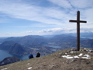
Monte Boglia (also known as Colma Regia) is a mountain whose peak is along the border of Ticino, Switzerland and Lombardy, Italy. It reaches an elevation of 1,516 metres and overlooks Lake Lugano on its southern side.

Denti della Vecchia
Mountain in Switzerland
Distance: Approx. 3656 meters
Latitude and longitude: 46.05277778,9.02305556
The Denti della Vecchia (1,491 m) (lit. "teeth of the old woman") are a mountain of the Lugano Prealps, located north of Lake Lugano on the border between Italy and Switzerland. They are composed of several summits of which the highest is named Sasso Grande.

Swiss Customs Museum
Distance: Approx. 4138 meters
Latitude and longitude: 45.999379,9.020972
The Swiss Customs Museum, or Museo doganale svizzero, is a museum located in the Swiss canton of Ticino. The museum is sited near Cantine di Gandria, directly across the Lake Lugano from the village of Gandria, and adjacent to the border with Italy. The museum was formerly a border post on that border, but now forms part of the Swiss National Museum.

Cima di Fojorina
Mountain in Switzerland
Distance: Approx. 4072 meters
Latitude and longitude: 46.06263889,9.07277778
The Cima di Fojorina (also spelled Cima di Fiorina) is a mountain of the Lugano Prealps, located on the border between Switzerland and Italy. It lies on the range separating the Val Colla from Lake Lugano.
San Bartolomeo, Valsolda
Distance: Approx. 371 meters
Latitude and longitude: 46.02808333,9.05938889
San Bartolomeo is a Baroque-style, Roman Catholic church located in the neighborhood of Loggio, in the territory of the commune of Valsolda, Province of Como, region of Lombardy, Italy. This church was founded in 1262, located between Loggio and Drano. Accessible by a set of stairs, the church was refurbished last in 1736, when the belltower was re-erected and granted a golden globe.
Moltrasio Formation
Geological formation in Italy and Switzerland
Distance: Approx. 4716 meters
Latitude and longitude: 46,9.1
The Moltrasio Formation also known as the Lombardische Kieselkalk Formation is a geological formation in Italy and Switzerland. This Formation mostly developed in the Lower or Middle Sinemurian stage of the Lower Jurassic, where on the Lombardian basin tectonic activity modified the current marine and terrestrial habitats. Here it developed a series of marine-related depositional settings, represented by an outcrop of 550–600 m of grey Calcarenites and Calcilutites with chert lenses and marly interbeds, that recovers the Sedrina, Moltrasio and Domaro Formations.
Weather in this IP's area
mist
21 Celsius
21 Celsius
20 Celsius
22 Celsius
1017 hPa
89 %
1017 hPa
967 hPa
4200 meters
1.03 m/s
75 %
06:00:29
20:59:51

