Country:
Region:
City:
Latitude and Longitude:
Time Zone:
Postal Code:
IP information under different IP Channel
ip-api
Country
Region
City
ASN
Time Zone
ISP
Blacklist
Proxy
Latitude
Longitude
Postal
Route
IPinfo
Country
Region
City
ASN
Time Zone
ISP
Blacklist
Proxy
Latitude
Longitude
Postal
Route
MaxMind
Country
Region
City
ASN
Time Zone
ISP
Blacklist
Proxy
Latitude
Longitude
Postal
Route
Luminati
Country
ASN
Time Zone
America/Chicago
ISP
UCSD
Latitude
Longitude
Postal
db-ip
Country
Region
City
ASN
Time Zone
ISP
Blacklist
Proxy
Latitude
Longitude
Postal
Route
ipdata
Country
Region
City
ASN
Time Zone
ISP
Blacklist
Proxy
Latitude
Longitude
Postal
Route
Popular places and events near this IP address

San Diego Mesa College
Community college in Clairemont Mesa, California, US
Distance: Approx. 446 meters
Latitude and longitude: 32.80444444,-117.17027778
San Diego Mesa College (Mesa College or Mesa) is a public community college in Clairemont Mesa in San Diego, California. It is a California Community College and one of four colleges in the San Diego Community College District. Community college education in San Diego began in 1914 when the Board of Education of the San Diego City Schools authorized post-secondary classes for San Diego high school students.

Linda Vista, San Diego
Community of San Diego in California
Distance: Approx. 1880 meters
Latitude and longitude: 32.78361111,-117.17111111
Linda Vista (Spanish for "Pretty View") is a community in San Diego, California, United States. Located east of Mission Bay, north of Mission Valley, and south-east of Tecolote Canyon, it lies on a mesa overlooking Mission Valley to the south and Mission Bay and the Pacific Ocean to the west. It is also home to the University of San Diego.

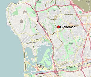
Clairemont, San Diego
Community of San Diego in California
Distance: Approx. 2848 meters
Latitude and longitude: 32.82046111,-117.19013333
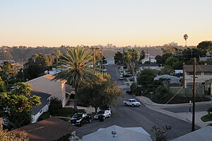
Clairemont (or Clairemont Mesa) is a community within the city of San Diego, California, United States. It has a population of about 81,600 residents and an area of roughly 13.3 square miles (34 km2). Clairemont Mesa is bordered by Interstate 805 on the east, Interstate 5 to the west, State Route 52 to the north, and the community of Linda Vista to the south.

Kearny High School (California)
Public school in San Diego, California, United States
Distance: Approx. 864 meters
Latitude and longitude: 32.7998,-117.1619
Kearny High School is a public high school in San Diego, California, United States. Kearny High School serves students in grades 9-12 from the Linda Vista, Serra Mesa and Kearny Mesa communities. The school is part of the San Diego Unified School District.
Western Sierra Law School
Distance: Approx. 2805 meters
Latitude and longitude: 32.81,-117.14333333
Western Sierra Law School (WSLS) is a private law school originally located in San Diego and recently relocated to North San Diego County in Oceanside, California. Western Sierra Law School was founded in 1979 and offers an affordable and accessible option to those looking to study the law, earn a Juris Doctor (J.D.) degree and qualify to sit for the California Bar Exam. Western Sierra Law School offers a part-time, evening, 4 year J.D. program that is designed to accommodate working professionals.
Pacific College of Health and Science
Distance: Approx. 2677 meters
Latitude and longitude: 32.7782,-117.1604
The Pacific College of Health and Science (previously the Pacific College of Oriental Medicine) is a private for-profit college of alternative medicine in the United States with campuses in San Diego, New York, and Chicago.
KSDS
Jazz music public radio station in San Diego
Distance: Approx. 511 meters
Latitude and longitude: 32.805,-117.17
KSDS (88.3 FM, "Jazz 88.3") is a full-time mainstream/traditional Jazz radio station, licensed to the San Diego Community College District, broadcasting 24 hours a day from the campus of San Diego City College. The station is owned by City College, although their transmitter and antenna are located near their partner college, Mesa College, located north of City College, in Kearny Mesa. KSDS, founded in 1951, began programming jazz in 1973 and in 1985 became San Diego's only full-time jazz and blues station.

Art Institute of California – San Diego
Former for-profit art school in San Diego, California
Distance: Approx. 2923 meters
Latitude and longitude: 32.778,-117.155
The Art Institute of California – San Diego was a for-profit art school in San Diego, California. It was briefly operated as a non-profit institution before it closed in 2019. The school was one of a number of Art Institutes, a franchise of for-profit art colleges with many branches in North America, owned and operated by Education Management Corporation.

Rady Children's Hospital
Hospital in California, United States
Distance: Approx. 1890 meters
Latitude and longitude: 32.79805556,-117.15111111
Rady Children's Hospital-San Diego is a nonprofit pediatric care facility. Rady Children's provides services to the San Diego, southern Riverside and Imperial counties. The hospital has 511 beds and provides comprehensive pediatric specialties and subspecialties to patients aged 0–21.

Birdland, San Diego
Community of San Diego in California
Distance: Approx. 1979 meters
Latitude and longitude: 32.78886111,-117.15511389
Birdland is a neighborhood in San Diego, California. It is located between California State Route 163, Interstate 805 and Mission Valley. Most of the streets in the area are named after different bird species, hence the name of the community.
Sharp Mary Birch Hospital for Women & Newborns
Hospital in California USA, founded 1992
Distance: Approx. 1511 meters
Latitude and longitude: 32.7994,-117.155
Sharp Mary Birch Hospital for Women & Newborns, part of Sharp HealthCare, is a 206-bed, not for profit hospital. Located in San Diego, California, Sharp Mary Birch Hospital delivers more babies than any other hospital in California.

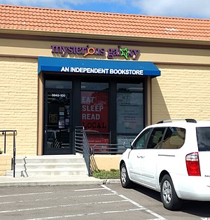
Mysterious Galaxy
Independent bookstore located in San Diego, California
Distance: Approx. 2187 meters
Latitude and longitude: 32.8194,-117.1775
Mysterious Galaxy is an independent bookstore located in San Diego, California. It was founded in 1993 and caters mostly to fans of genre fiction such as mystery, fantasy, science fiction, and horror. It is noted for hosting book signings and readings by numerous authors of the genres.
Weather in this IP's area
mist
18 Celsius
19 Celsius
17 Celsius
20 Celsius
1011 hPa
87 %
1011 hPa
1000 hPa
10000 meters
2.06 m/s
260 degree
05:59:22
19:50:46