Country:
 India
IndiaRegion:
City:
Latitude and Longitude:
Time Zone:
Postal Code:
IP information under different IP Channel
ip-api
Country
Region
City
ASN
Time Zone
ISP
Blacklist
Proxy
Latitude
Longitude
Postal
Route
IPinfo
Country
Region
City
ASN
Time Zone
ISP
Blacklist
Proxy
Latitude
Longitude
Postal
Route
MaxMind
Country
Region
City
ASN
Time Zone
ISP
Blacklist
Proxy
Latitude
Longitude
Postal
Route
Luminati
Country
INASN
Time Zone
Asia/Kolkata
ISP
Mahanagar Telephone Nigam Limited
Latitude
Longitude
Postal
db-ip
Country
Region
City
ASN
Time Zone
ISP
Blacklist
Proxy
Latitude
Longitude
Postal
Route
ipdata
Country
Region
City
ASN
Time Zone
ISP
Blacklist
Proxy
Latitude
Longitude
Postal
Route
Popular places and events near this IP address
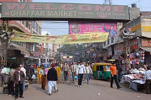
Karol Bagh
Neighbourhood in Central Delhi, Delhi, India
Distance: Approx. 785 meters
Latitude and longitude: 28.6629,77.21
Karol Bagh (also spelled Qarol Bagh, pronounced [qəroːl baːɣ]) is a neighborhood in Central District of Delhi, India. It is a mixed residential and commercial neighborhood known for shopping streets, such as the Ghaffar Market and Ajmal Khan Road. It was home to the Karol Bagh Lok Sabha constituency until it was abolished in 2008.

Sadar Bazaar, Delhi
Place in Delhi, India
Distance: Approx. 889 meters
Latitude and longitude: 28.658813,77.216742
Sadar Bazaar is the largest wholesale cosmetics jewellery market of household items in Old Delhi, Delhi, India. Like other major markets of Old Delhi, this market is very crowded and buzzes with activity. Although it is primarily a wholesale market, it also caters to occasional retail buyers.

Vidyajyoti College of Theology
Theological college in Delhi
Distance: Approx. 789 meters
Latitude and longitude: 28.6725,77.2215
Vidyajyoti College of Theology (literally, ‘Light of Knowledge’) is a Catholic private theological college run by the Jesuits located in Delhi, India. It was started in 1879 in Asansol, West Bengal, as a modest 'Saint Joseph’s Seminary'. From 1889 to 1971 it developed in the mountains of Kurseong, near Darjeeling, where it was renamed Saint Mary’s College.
Tis Hazari
Neighborhood of Delhi in North India, India
Distance: Approx. 134 meters
Latitude and longitude: 28.6656,77.2168
Tis Hazari is a neighbourhood in Old Delhi, India just south of the Northern Ridge. It is the location of the Tis Hazari Courts Complex which was inaugurated on 19 March 1958 by Chief Justice Mr. A. N. Bhandari of the then Punjab High Court.

Raj Niwas, Delhi
Residence of the Lt. Governor of Delhi
Distance: Approx. 702 meters
Latitude and longitude: 28.6721,77.2206
Raj Niwas (translation: Government House) is the official residence of the Lieutenant Governor of Delhi, the head of state of Delhi and Government of National Capital Territory of Delhi. It is located on Raj Niwas Marg, Civil Lines, Delhi. The present lieutenant governor of Delhi is Vinai Kumar Saxena, since May 23, 2022.
St. Xavier's School, Rohini
School in India
Distance: Approx. 808 meters
Latitude and longitude: 28.6717,77.2228
St. Xavier's School, Rohini is a private Catholic primary and secondary school located in Shahbad Daulatpur, Sector 26, Rohini, Delhi, India. Established in 1966 and managed by the Jesuits since 1990, the Christian-minority English medium school is coeducational and recognized by the Board of Education Delhi Administration and is affiliated to the Central Board of Secondary Education (CBSE), with science, commerce, and humanities streams.

Mutiny Memorial
Distance: Approx. 768 meters
Latitude and longitude: 28.67111111,77.21055556
The Mutiny Memorial, now known as Ajitgarh, is a memorial situated on the Ridge New Delhi. It was built in memory of all those who had fought in the Delhi Field Force, British and Indian, during the Indian Revolt of 1857.

Khari Baoli
Neighborhood of Delhi in India
Distance: Approx. 985 meters
Latitude and longitude: 28.6588423,77.2211152
Khari Baoli (Hindustani: [kʰ aːriː baːwriː]) is a street in Delhi, India known for its wholesale grocery and Asia's largest wholesale spice market selling a variety of spices, nuts, herbs and food products like rice and tea. Operating since the 17th century, the market is situated near the historic Delhi Red Fort, on the Khari Baoli Road adjacent to Fatehpuri Masjid at the western end of the Chandni Chowk, and over the years has remained a tourist attraction, especially those in the heritage circuit of Old Delhi.

St. Xavier's Senior Secondary School, Delhi
School in North Delhi, India
Distance: Approx. 793 meters
Latitude and longitude: 28.67277778,77.22111111
St. Xavier’s Senior Secondary School is a private Catholic primary and secondary school located in Raj Niwas Marg in the Civil Lines area of North Delhi, in India. Founded by the Jesuits in 1960 as a residential school for boys only, the school has become a Christian minority neighbourhood co-educational school catering for students from preparatory to Grade 12.

Tis Hazari metro station
Metro station in Delhi, India
Distance: Approx. 48 meters
Latitude and longitude: 28.66719444,77.2165
The Tis Hazari metro station is a metro station located on the Red Line of Delhi Metro. It is situated in the Tis Hazari area of Central Delhi. The station is situated just across the road from the Tis Hazari Courts Complex, which is the principal district court of Delhi.

Pul Bangash metro station
Metro station in Delhi, India
Distance: Approx. 949 meters
Latitude and longitude: 28.66630556,77.207
The Pulbangash metro station is located on the Red Line of the Delhi Metro.
Sadar Bazar railway station
Railway station in Delhi, India
Distance: Approx. 913 meters
Latitude and longitude: 28.6586,77.2168
Sadar Bazar railway station, with the three-letter station code DSB, is a railway station located in the Sadar Bazar area of Delhi's Central Delhi district. The station, which has four platforms and three radiating lines, is maintained by Northern Railways and has been ranked NSG-4 as per the categorization of Indian Railway stations by commercial importance.
Weather in this IP's area
mist
30 Celsius
37 Celsius
30 Celsius
30 Celsius
997 hPa
94 %
997 hPa
973 hPa
2500 meters
2.06 m/s
100 degree
20 %
05:39:37
19:15:25