Country:
 Qatar
QatarRegion:
City:
Latitude and Longitude:
Time Zone:
Postal Code:
IP information under different IP Channel
ip-api
Country
Region
City
ASN
Time Zone
ISP
Blacklist
Proxy
Latitude
Longitude
Postal
Route
IPinfo
Country
Region
City
ASN
Time Zone
ISP
Blacklist
Proxy
Latitude
Longitude
Postal
Route
MaxMind
Country
Region
City
ASN
Time Zone
ISP
Blacklist
Proxy
Latitude
Longitude
Postal
Route
Luminati
Country
QAASN
Time Zone
Asia/Qatar
ISP
Qatar Foundation for Education, Science and Community Development
Latitude
Longitude
Postal
db-ip
Country
Region
City
ASN
Time Zone
ISP
Blacklist
Proxy
Latitude
Longitude
Postal
Route
ipdata
Country
Region
City
ASN
Time Zone
ISP
Blacklist
Proxy
Latitude
Longitude
Postal
Route
Popular places and events near this IP address
1995 FIFA World Youth Championship
International football competition
Distance: Approx. 553 meters
Latitude and longitude: 25.28194444,51.5175
The 1995 FIFA World Youth Championship, known as the 1995 FIFA/Coca-Cola World Youth Championship for sponsorship purposes, was the 10th edition of the FIFA World Youth Championship. It was held in Qatar from 13 to 28 April 1995. The tournament took place in three venues within the city of Doha.
Abu Sudayrah
Place in Ad Dawhah, Qatar
Distance: Approx. 1014 meters
Latitude and longitude: 25.28138889,51.5125
Abu Sudayrah is a settlement in Qatar, located in the municipality of Ad Dawhah. It is located 3 miles from Doha International Airport. Nearby towns and villages include As Sadd (0.5 nm), Al Bida` al Gharbiyah (0.8 nm), `Abd al `Aziz (0.7 nm).

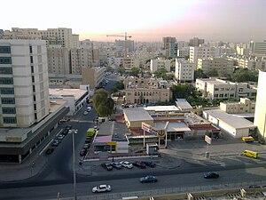
Mushayrib
District in Ad-Dawhah, Qatar
Distance: Approx. 705 meters
Latitude and longitude: 25.28333333,51.51666667
Mushayrib (Arabic: مشيرب; also spelled Musheireb) is a Qatari district located in the municipality of Ad Dawhah. As of the 2010 census, the former district of Al Asmakh has been integrated into Mushayrib. It is one of the oldest districts of Doha, and contains Al Kahraba Street (also called Electricity Street), the country's first fully lit street.
Fereej Abdel Aziz
District in Ad-Dawhah, Qatar
Distance: Approx. 255 meters
Latitude and longitude: 25.27805556,51.52416667
Fereej Abdel Aziz (Arabic: فريج عبد العزيز, romanized: Farīq ‘Abd al ‘Azīz) is a Qatari district located in the municipality of Ad Dawhah.

Fereej Bin Mahmoud
District in Ad-Dawhah, Qatar
Distance: Approx. 898 meters
Latitude and longitude: 25.27833333,51.51361111
Fereej Bin Mahmoud (Arabic: فريج بن محمود, romanized: Farīj Bin Maḥmūd) is a neighborhood of Doha, Qatar. It is one of the older multipurpose districts, with an active business scene and relatively large housing market. Located in Doha's downtown area, next to the historic district of Mushayrib, the area underwent considerable development in the 1970s.
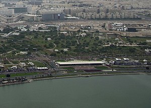
Rumeilah (Doha)
District in Ad-Dawhah, Qatar
Distance: Approx. 1172 meters
Latitude and longitude: 25.28333333,51.53333333
Rumeilah (Arabic: اَلرُّمَيْلَة, romanized: Ar Rumaylah; also spelled Rumaila) is a neighborhood of Doha, Qatar. It is divided into an eastern and western section. Zone 11, the eastern section, hosts roughly half of Al Bidda Park while Zone 21 contains most of Hamad Medical Corporation's facilities.

Al Koot Fort
Fortress in Doha, Qatar
Distance: Approx. 1150 meters
Latitude and longitude: 25.2866,51.5309
Al Koot Fort most commonly known as the Doha Fort, is a historical military fortress located in the heart of Doha, Qatar's capital city. It was built in 1927 by Sheikh Abdulla bin Qassim Al Thani, better known as Sheikh Abdullah bin Jassim Al Thani, who ruled Qatar from 1913 until 1949, after Sheikh Mohammed bin Jassim Al Thani, Sheikh Abdullah's brother, abdicated in favor of him. The fort was later converted into a museum.
Rawdat Al Khail
District in Ad-Dawhah, Qatar
Distance: Approx. 1031 meters
Latitude and longitude: 25.27083333,51.51944444
Rawdat Al Khail (Arabic: روضة الخيل, romanized: Rawḑat al Khayl; also known as Al Muntazah) is a Qatari district in the municipality of Doha. It lies just outside the boundary of downtown Doha to the east. As part of the district's master plan, major mixed use developments are being carried along the arterial roads of C Ring Road and Salwa Road.

Al Najada
District in Ad-Dawhah, Qatar
Distance: Approx. 865 meters
Latitude and longitude: 25.28333333,51.53
Al Najada (Arabic: النجادة, romanized: An-Najādah) is a Qatari district in the municipality of Doha. It is one of the oldest districts of Doha. Doha's rapid urbanization during the 1970s after it gained independence resulted in the gradual decline of Al Najada.
Msheireb station
Metro station in Doha, Qatar
Distance: Approx. 478 meters
Latitude and longitude: 25.28278,51.52571
Msheireb (Arabic: مشيرب) is a rapid transit station in Doha, Qatar located between Msheireb Downtown Doha and Mushayrib. It serves as a transfer station for the Red, Gold and Green lines of the Doha Metro and is considered the largest station in the city.

Fereej Al Asmakh
District in Ad-Dawhah, Qatar
Distance: Approx. 1100 meters
Latitude and longitude: 25.280442,51.533298
Fereej Al Asmakh (Arabic: فريج الأصمخ, romanized: Farīj al-'Aṣmakh) is a Qatari district located in the municipality of Ad Dawhah. Administratively, it is part of Zone 5, along with Al Najada and Barahat Al Jufairi. It is one of the smaller and older districts of Doha.
Fereej Mohammed Bin Jasim
District in Ad Dawhah, Qatar
Distance: Approx. 781 meters
Latitude and longitude: 25.28555556,51.52666667
Fereej Mohammed Bin Jasim (Arabic: فريج محمد بن جاسم, romanized: Farīj Moḥammed Bin Jāsim) is a district in Qatar, located in the municipality of Ad Dawhah. It is bordered by Mushayrib, which it shares Zone 3 with. The district was first mentioned in the 1940s.
Weather in this IP's area
clear sky
44 Celsius
45 Celsius
43 Celsius
45 Celsius
996 hPa
19 %
996 hPa
995 hPa
10000 meters
9.77 m/s
10 degree
04:58:36
18:21:59