Country:
 France
Region:
City:
Latitude and Longitude:
Time Zone:
Postal Code:
IP information under different IP Channel
ip-api
Country
Region
City
ASN
Time Zone
ISP
Blacklist
Proxy
Latitude
Longitude
Postal
Route
IPinfo
Country
Region
City
ASN
Time Zone
ISP
Blacklist
Proxy
Latitude
Longitude
Postal
Route
MaxMind
Country
Region
City
ASN
Time Zone
ISP
Blacklist
Proxy
Latitude
Longitude
Postal
Route
Luminati
Country
FRASN
Time Zone
Europe/Paris
ISP
Free SAS
Latitude
Longitude
Postal
db-ip
Country
Region
City
ASN
Time Zone
ISP
Blacklist
Proxy
Latitude
Longitude
Postal
Route
ipdata
Country
Region
City
ASN
Time Zone
ISP
Blacklist
Proxy
Latitude
Longitude
Postal
Route
Popular places and events near this IP address

Andernos-les-Bains
Commune in Nouvelle-Aquitaine, France
Distance: Approx. 4352 meters
Latitude and longitude: 44.7433,-1.0892
Andernos-les-Bains (French pronunciation: [ɑ̃dɛʁnɔs le bɛ̃] ; Occitan: Endarnòs) is a commune in the Gironde department, southwestern France. Andernos-les-Bains is located on the northeast shore of Arcachon Bay. To its northwest is the town of Arès.
Grand Piquey
Distance: Approx. 8536 meters
Latitude and longitude: 44.71416667,-1.21194444
Grand Piquey is a village in the Gironde département, close to Bordeaux and on Arcachon Bay. It is part of the commune Lège-Cap-Ferret.

Arcachon Bay
Delta and basin in France
Distance: Approx. 9648 meters
Latitude and longitude: 44.68333333,-1.16666667
Arcachon Basin or alternatively Arcachon Bay (French: Bassin d'Arcachon, French pronunciation: [basɛ̃ daʁkaʃɔ̃]; Gascon: Laca d'Arcaishon) is a bay of the Atlantic Ocean on the southwest coast of France, situated in Pays de Buch between the Côte d'Argent and the Côte des Landes, in the region of Aquitaine. The bay covers an area of 150 square kilometres (60 sq mi) at high tide and 40 km2 (15 sq mi) at low tide. Some of its geological features are natural preservation areas.

Lège-Cap-Ferret
Commune in Nouvelle-Aquitaine, France
Distance: Approx. 3173 meters
Latitude and longitude: 44.7939,-1.1453
Lège-Cap-Ferret (French pronunciation: [lɛʒ kap fɛʁɛ]; Gascon: Lèja e lo Horet) is a commune in the Gironde department in Nouvelle-Aquitaine in southwestern France. The commune stretches along the length of the Cap Ferret peninsula, from the village of Lège in the north to the point of Cap Ferret in the south.
Arès
Commune in Nouvelle-Aquitaine, France
Distance: Approx. 187 meters
Latitude and longitude: 44.7658,-1.1353
Arès (French pronunciation: [aʁɛs]; Occitan: Arés, pronounced [aˈɾes]) is a commune in the department of Gironde, in the region of Nouvelle-Aquitaine, southwestern France.
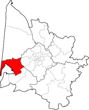
Canton of Andernos-les-Bains
Canton in Nouvelle-Aquitaine, France
Distance: Approx. 3970 meters
Latitude and longitude: 44.74,-1.1
The canton of Andernos-les-Bains is an administrative division of the Gironde department, southwestern France. It was created at the French canton reorganisation which came into effect in March 2015. Its seat is in Andernos-les-Bains.
ONA (restaurant)
Restaurant
Distance: Approx. 553 meters
Latitude and longitude: 44.76629,-1.14027
ONA was a vegan restaurant in Arès, France owned by chef Claire Vallée and was the first vegan restaurant to receive a Michelin star. The name stands for origine non-animale and the restaurant uses no animal products in its food, decorations or furnishings. ONA was opened in 2016 by Vallée, a self-taught chef, and offered a seven-course tasting menu.
Weather in this IP's area
overcast clouds
23 Celsius
24 Celsius
23 Celsius
24 Celsius
1015 hPa
81 %
1015 hPa
1014 hPa
10000 meters
0.16 m/s
0.3 m/s
16 degree
100 %
06:45:13
21:36:37