Country:
Region:
City:
Latitude and Longitude:
Time Zone:
Postal Code:
IP information under different IP Channel
ip-api
Country
Region
City
ASN
Time Zone
ISP
Blacklist
Proxy
Latitude
Longitude
Postal
Route
IPinfo
Country
Region
City
ASN
Time Zone
ISP
Blacklist
Proxy
Latitude
Longitude
Postal
Route
MaxMind
Country
Region
City
ASN
Time Zone
ISP
Blacklist
Proxy
Latitude
Longitude
Postal
Route
Luminati
Country
Region
84
City
bronshoj
ASN
Time Zone
Europe/Copenhagen
ISP
Dansk Kabel Tv A/s
Latitude
Longitude
Postal
db-ip
Country
Region
City
ASN
Time Zone
ISP
Blacklist
Proxy
Latitude
Longitude
Postal
Route
ipdata
Country
Region
City
ASN
Time Zone
ISP
Blacklist
Proxy
Latitude
Longitude
Postal
Route
Popular places and events near this IP address

Right to Dream Park
Football stadium in Farum, Denmark
Distance: Approx. 5410 meters
Latitude and longitude: 55.815847,12.353289
Right to Dream Park, historically known as Farum Park, is a football stadium, located in Farum, Denmark, and is the home ground of FC Nordsjælland. It has a capacity of 10,300 of which 9,800 are seated. Farum Park is the first stadium in the Danish Superliga with an artificial turf, installed in 2012.

Allerød railway station
Railway station in North Zealand, Denmark
Distance: Approx. 6082 meters
Latitude and longitude: 55.871,12.357
Allerød station is a railway station serving the town of Lillerød in Allerød municipality north of Copenhagen, Denmark. It is located on the Hillerød radial of Copenhagen's S-train network. The station opened in 1864.

Lynge, Allerød Municipality
Town in Capital Region, Denmark
Distance: Approx. 286 meters
Latitude and longitude: 55.83972222,12.27305556
Lynge is a town in the western part of Allerød Municipality, North Zealand, some 30 km north of Copenhagen, Denmark. Today Lynge has grown together with the neighbouring village of Uggeløse into a small urban area with a population of 4,123 (1 January 2024).

Lillerød
Place in Capital, Denmark
Distance: Approx. 5119 meters
Latitude and longitude: 55.86805556,12.34166667
Lillerød (sometimes named Allerød) is a Danish town, seat of the Allerød Municipality, in the Region Hovedstaden. Its population 1 January 2024 was of 16,801.

Jørlunde
Distance: Approx. 5931 meters
Latitude and longitude: 55.83333333,12.18333333
Jørlunde is a village with a population of 295 (1 January 2024) in North Zealand in Denmark. In the late Viking age and early medieval age, Jørlunde was the center of the Hvide clan. Jørlunde Church (Joerlunde Kirke) was erected by Skjalm Hvide around the year 1100.
Scandinavian Golf Club
Golf Club in Denmark
Distance: Approx. 3931 meters
Latitude and longitude: 55.835,12.34
The Scandinavian Golf Club is a venue for golfers with two 18-hole courses (Old & New Course) designed by American Robert Trent Jones II. The club house was designed by Henning Larsen Architects.
Nymølle, Allerød Municipality
Hamlet in Capital Region, Denmark
Distance: Approx. 2200 meters
Latitude and longitude: 55.82527778,12.30222222
Nymølle is a village in the Parish of Uggeløse, Allerød Municipality, located approximately 28 km north of Copenhagen, Denmark. It is located three kilometres east of Lynge-Uggeløse and five kilometres west of Farum.

Brudevælte Lurs
Distance: Approx. 1908 meters
Latitude and longitude: 55.855556,12.287778
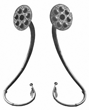
The Brudevælte Lurs, found in a bog north of Lynge on the Danish island of Zealand, are six lurs, which are so well preserved that they can still be played.

Ganløse
Town in Capital Region, Denmark
Distance: Approx. 5344 meters
Latitude and longitude: 55.79194444,12.26472222
Ganløse is a town located in the Egedal Municipality, in the Capital Region of Denmark.

Lillerød Church
Distance: Approx. 5712 meters
Latitude and longitude: 55.87348,12.34595
Lillerød Church (Danish: Lillerød Kirke) is a parish church in Lillerød, Allerød Municipality, some 20 km north of central Copenhagen, Denmark.
Buresø (town)
Town in Denmark
Distance: Approx. 4073 meters
Latitude and longitude: 55.81361111,12.23138889
Buresø, is a small town in Egedal Municipality. It has a population of 461 (2024). The town is located on the northern part of the island of Zealand (Sjælland), in eastern Denmark.

Buresø
Distance: Approx. 4069 meters
Latitude and longitude: 55.825,12.21777778
Buresø is a lake located in a tunnel valley, immediately southeast of Slangerup, where Allerød, Frederikssund and Egedal municipalities meet. The tunnel valley, which was formed during the last ice age, runs in an east-west direction and can be followed along Mølleåen all the way to the Øresund coast. Between Buresø and the nearby Bastrup Sø there is a watershed.
Weather in this IP's area
broken clouds
15 Celsius
15 Celsius
13 Celsius
15 Celsius
1012 hPa
96 %
1012 hPa
1006 hPa
10000 meters
2.72 m/s
5.33 m/s
268 degree
77 %
05:07:02
21:27:31