Country:
 USA
USARegion:
City:
Latitude and Longitude:
Time Zone:
Postal Code:
IP information under different IP Channel
ip-api
Country
Region
City
ASN
Time Zone
ISP
Blacklist
Proxy
Latitude
Longitude
Postal
Route
IPinfo
Country
Region
City
ASN
Time Zone
ISP
Blacklist
Proxy
Latitude
Longitude
Postal
Route
MaxMind
Country
Region
City
ASN
Time Zone
ISP
Blacklist
Proxy
Latitude
Longitude
Postal
Route
Luminati
Country
USRegion
tn
City
lafollette
ASN
Time Zone
America/New_York
ISP
ENA
Latitude
Longitude
Postal
db-ip
Country
Region
City
ASN
Time Zone
ISP
Blacklist
Proxy
Latitude
Longitude
Postal
Route
ipdata
Country
Region
City
ASN
Time Zone
ISP
Blacklist
Proxy
Latitude
Longitude
Postal
Route
Popular places and events near this IP address

Roane County, Tennessee
County in Tennessee, United States
Distance: Approx. 1361 meters
Latitude and longitude: 35.87,-84.50166667
Roane County is a county of the U.S. state of Tennessee. As of the 2020 census, the population was 53,404. Its county seat is Kingston.

Kingston, Tennessee
City in Tennessee, United States
Distance: Approx. 12 meters
Latitude and longitude: 35.88083333,-84.50861111
Kingston is a city in and the county seat of Roane County, Tennessee, United States. This city is thirty-six miles southwest of Knoxville. It had a population of 5,934 at the 2010 United States census, and is included in the Harriman, Tennessee Micropolitan Statistical Area.

Emory River
River in Tennessee, United States
Distance: Approx. 1709 meters
Latitude and longitude: 35.8875,-84.49138889
The Emory River is a river draining a portion of Tennessee's Cumberland Plateau. It flows for just over 46 miles (74 km) from its source near Frozen Head State Park to its mouth along the Clinch River at Kingston, Tennessee.

Clinch River
River in Virginia and Tennessee, US
Distance: Approx. 2862 meters
Latitude and longitude: 35.86333333,-84.53166667
The Clinch River is a river that flows southwest for more than 300 miles (480 km) through the Great Appalachian Valley in the U.S. states of Virginia and Tennessee, gathering various tributaries, including the Powell River, before joining the Tennessee River in Kingston, Tennessee. The Clinch River is dammed twice: by Norris Dam, the first dam built by the Tennessee Valley Authority (TVA); and by the Melton Hill Dam, the only TVA dam with a navigation lock that is not located on the main channel of the Tennessee River. An important tributary of the Clinch River is the Powell River.

Kingston Fossil Plant
Coal-fired power plant in Tennessee, United States
Distance: Approx. 2155 meters
Latitude and longitude: 35.89833333,-84.51888889
Kingston Fossil Plant, commonly known as Kingston Steam Plant, is a 1.4-gigawatt (1,398 MW) coal-fired power plant located in Roane County, just outside Kingston, Tennessee, on the shore of Watts Bar Lake. It is operated by the Tennessee Valley Authority. The plant is known for the Kingston Fossil Plant fly ash spill which occurred in December 2008.

Roane County Courthouse (Tennessee)
United States historic place
Distance: Approx. 1222 meters
Latitude and longitude: 35.87166667,-84.51583333
The old Roane County Courthouse building in Kingston, Tennessee, the county seat of Roane County. Built in the 1850s, it is one of six remaining antebellum county courthouses in the state of Tennessee. The old courthouse was the county's second courthouse building, replacing the original brick courthouse built in 1803.
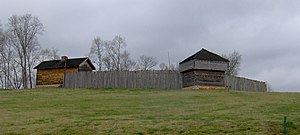
Fort Southwest Point
United States historic place
Distance: Approx. 2933 meters
Latitude and longitude: 35.86056,-84.52917
Fort Southwest Point was a federal frontier outpost at what is now Kingston, Tennessee, in the Southeastern United States. Constructed in 1797 and garrisoned by federal soldiers until 1811, the fort served as a major point of interaction between the Cherokee and the United States government as well as a way station for early migrants travelling between Knoxville and Nashville. Although there are no records and few contemporary descriptions pertaining to the fort's design and structure, archaeological excavations conducted in the 1970s and 1980s have determined the fort's layout.
WVVB (AM)
Radio station in Kingston, Tennessee
Distance: Approx. 640 meters
Latitude and longitude: 35.88027778,-84.51555556
WVVB (1410 AM) is a daytime only radio station originally broadcasting a gospel format. Licensed to Kingston, Tennessee, United States, the station is currently owned by John and Brannigan Tollett, through licensee 3B Tennessee, Inc. On September 1, 2018, the then-WBBX was renamed 94.1 The Vibe.

Kingston Fossil Plant coal fly ash slurry spill
2008 environmental disaster in Tennessee, US
Distance: Approx. 3780 meters
Latitude and longitude: 35.91472222,-84.51222222
The Kingston Fossil Plant coal fly ash slurry spill was an environmental and industrial disaster that occurred on December 22, 2008, when a dike ruptured at a coal ash pond at the Tennessee Valley Authority's Kingston Fossil Plant in Roane County, Tennessee, releasing 1.1 billion US gallons (4.2 million cubic metres) of coal fly ash slurry. The coal-fired power plant, located across the Clinch River from the city of Kingston, used a series of ponds to store and dewater the fly ash, a byproduct of coal combustion. The spill released a slurry of fly ash and water which traveled across the Emory River and its Swan Pond embayment onto the opposite shore, covering up to 300 acres (1.2 km2) of the surrounding land.
Roane County High School
School in Kingston, Tennessee, United States
Distance: Approx. 1249 meters
Latitude and longitude: 35.875,-84.52027778
Located in Kingston, Tennessee, Roane County High School or better known as Kingston is the largest of five high schools in Roane County. The school mascot is the Yellow Jackets. The school colors are navy and orange.

Col. Gideon Morgan House
Historic house in Tennessee, United States
Distance: Approx. 1200 meters
Latitude and longitude: 35.87222222,-84.51638889
The Col. Gideon Morgan House is a historic house in Kingston, Tennessee.

Battle of Kingston
Battle of the American Civil War
Distance: Approx. 12 meters
Latitude and longitude: 35.88083333,-84.50861111
The Battle of Kingston (November 24, 1863) saw Major General Joseph Wheeler with two divisions of Confederate cavalry attempt to overcome the Union garrison of Kingston, Tennessee, led by Colonel Robert K. Byrd. The Confederates mistakenly believed that the Kingston garrison was weak, but in fact, it comprised a brigade of infantry and a regiment of mounted infantry. When Wheeler's cavalrymen began probing the Union position, they discovered that its defenders were too numerous, and the position was too strong.
Weather in this IP's area
mist
22 Celsius
23 Celsius
21 Celsius
23 Celsius
1018 hPa
99 %
1018 hPa
988 hPa
8047 meters
100 %
06:42:02
20:46:48