Country:
 Canada
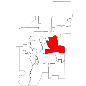
Region:
City:
Latitude and Longitude:
Time Zone:
Postal Code:
IP information under different IP Channel
ip-api
Country
Region
City
ASN
Time Zone
ISP
Blacklist
Proxy
Latitude
Longitude
Postal
Route
IPinfo
Country
Region
City
ASN
Time Zone
ISP
Blacklist
Proxy
Latitude
Longitude
Postal
Route
MaxMind
Country
Region
City
ASN
Time Zone
ISP
Blacklist
Proxy
Latitude
Longitude
Postal
Route
Luminati
Country
CARegion
ab
City
edmonton
ASN
Time Zone
America/Edmonton
ISP
SHAW
Latitude
Longitude
Postal
db-ip
Country
Region
City
ASN
Time Zone
ISP
Blacklist
Proxy
Latitude
Longitude
Postal
Route
ipdata
Country
Region
City
ASN
Time Zone
ISP
Blacklist
Proxy
Latitude
Longitude
Postal
Route
Popular places and events near this IP address

Commonwealth Stadium
Multiuse stadium in Edmonton, Alberta, Canada
Distance: Approx. 1007 meters
Latitude and longitude: 53.55833333,-113.475
Commonwealth Stadium is an open-air, multipurpose stadium located in the McCauley neighbourhood of Edmonton, Alberta, Canada. It has a seating capacity of 56,302, making it the largest open-air stadium in Canada. Primarily used for Canadian football, it also hosts athletics, soccer, rugby union and concerts.

Clarke Stadium
Stadium in Edmonton, Alberta, Canada
Distance: Approx. 1017 meters
Latitude and longitude: 53.55722222,-113.47833333
Clarke Stadium is a multipurpose facility located in Edmonton, Alberta, Canada. The stadium was originally built for Canadian football. Over the years different sports have participated at the site.
Edmonton-Gold Bar
Provincial electoral district in Alberta, Canada
Distance: Approx. 981 meters
Latitude and longitude: 53.5588,-113.4663
Edmonton-Gold Bar is a provincial electoral district, in Alberta, Canada. The district is one of 87 in the province mandated to return a single member to the Legislative Assembly of Alberta using the first past the post method of voting. The district is primarily urban and located in the central east portion of city of Edmonton.

Stadium station (Edmonton)
Light rail station in Canada
Distance: Approx. 1111 meters
Latitude and longitude: 53.56,-113.47083333
Stadium station is an Edmonton LRT station in Edmonton, Alberta, Canada. It serves the Capital Line. It is a ground-level station located at 111 Avenue and 84 Street, next to Commonwealth Stadium and Clarke Stadium.

Edmonton Fire Rescue Services
Fire department for the city of Edmonton, Alberta, Canada
Distance: Approx. 1012 meters
Latitude and longitude: 53.5478,-113.4835
Edmonton Fire Rescue Services (also Edmonton Fire and Rescue Services) is the fire department for the city of Edmonton, Alberta, Canada. The Edmonton Fire Department began as a volunteer fire corps in 1891 and the first full department was created in 1906.

Dawson Bridge
Bridge in Edmonton, Alberta, Canada
Distance: Approx. 185 meters
Latitude and longitude: 53.54877778,-113.467
The Dawson Bridge is a two lane bridge that spans the North Saskatchewan River in Edmonton, Alberta, Canada. In early 2010, it underwent repairs, and later reopened on December 20, 2010. Dawson Bridge connects the communities of Forest Heights on the east end to Riverdale on the west end.

Grierson Centre
Minimum Security Prison in Alberta, Canada
Distance: Approx. 992 meters
Latitude and longitude: 53.54388889,-113.47944444
The Grierson Centre, also known as Grierson Institution, is a minimum security prison and historic site in Downtown Edmonton, Alberta, Canada. The institution is operated by the Correctional Service of Canada. The Grierson Centre originally served as the North-West Mounted Police's Divisional headquarters in Edmonton upon its completion in 1912.

McNally High School
10-12 school in Edmonton, Alberta (est. 1964)
Distance: Approx. 652 meters
Latitude and longitude: 53.54861111,-113.45916667
McNally High School is a high school located in the Forest Heights neighborhood in Edmonton, Alberta, Canada. It is operated by the Edmonton Public Schools system. The school is named after former Alberta Deputy Minister of Education and University of Alberta chancellor George Fred McNally.
Forest Heights Park
Municipal park in Canada
Distance: Approx. 941 meters
Latitude and longitude: 53.5435,-113.4598
Forest Heights Park is a municipal park in Edmonton, Alberta, Canada, and is one of the largest parks in the Edmonton North Saskatchewan valley parks system. It overlooks the North Saskatchewan River, as well as downtown Edmonton. The park is mostly located in the Forest Heights neighborhood.
Rat Creek
River in Alberta, Canada
Distance: Approx. 1195 meters
Latitude and longitude: 53.559245,-113.459237
Rat Creek is a tributary to the North Saskatchewan River. Rat Creek was once part of a much larger system which formerly almost connected to the Sturgeon River. However, Rat Creek is now defined as a lost creek, due to the city of Edmonton's encroachment on the surrounding area for urban use.

Quarters stop
Light rail station in Edmonton, Alberta, Canada
Distance: Approx. 1170 meters
Latitude and longitude: 53.54444444,-113.48361111
Quarters stop is a tram stop in the Edmonton LRT network in Edmonton, Alberta, Canada. It serves the Valley Line, and is located on the south side 102 Avenue, west of 96 Street, in Boyle Street. The stop was scheduled to open in 2020, but it officially opened on November 4, 2023.
Latta Bridge
Bridge in Alberta, Canada
Distance: Approx. 354 meters
Latitude and longitude: 53.55043,-113.47402
Latta Bridge is a road bridge in Edmonton, Alberta, Canada. It carries Jasper Avenue over the Latta Ravine, between 90 Street and 91 Street. The original bridge, a wooden trestle, was constructed in 1911, by its namesake, David Latta, who was a businessman and an alderman in Edmonton.
Weather in this IP's area
moderate rain
13 Celsius
13 Celsius
13 Celsius
14 Celsius
1004 hPa
88 %
1004 hPa
934 hPa
10000 meters
6.17 m/s
9.26 m/s
280 degree
100 %
05:40:30
21:40:02