Country:
 Chinese mainland
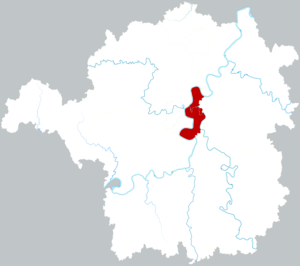
Region:
City:
Latitude and Longitude:
Postal Code:
Time Zone:
language:
User-Agent:
Proxy IP:
Blacklist:
IP information under different IP Channel
ip-api
Country
IPinfo
Country
MaxMind
Country
Luminati
113.220.64.254Country
CNASN
Time Zone
Asia/Shanghai
ISP
Chinanet
Latitude
Longitude
Postal
db-ip
Country
ipdata
Country
Popular places and events near this IP address

Hengyang
Prefecture-level city in Hunan, China
Distance: Approx. 4319 meters
Latitude and longitude: 26.894,112.572
Hengyang (simplified Chinese: 衡阳; traditional Chinese: 衡陽; pinyin: Héngyáng; Mandarin pronunciation: [xə̌ŋ.jǎŋ]) is the second largest city of Hunan Province, China. It straddles the Xiang River about 160 km (99 mi) south of the provincial capital of Changsha. As of the 2020 Chinese census, Its total population was 6,645,243 inhabitants, whom 1,290,715 lived in the built-up (or metro) area consisting of 4 urban districts, Nanyue District not being conurbated yet.
University of South China
Public university in Hengyang, Hunan, China
Distance: Approx. 2669 meters
Latitude and longitude: 26.9046,112.5955
The University of South China (南华大学), also as Nanhua University, is a provincial public university in the city of Hengyang, Hunan, China.
Battle of Hengyang
1944 battle in mainland China
Distance: Approx. 4473 meters
Latitude and longitude: 26.89,112.57
The Battle of Hengyang (Chinese: 衡阳保卫战) 23 June – 8 August 1944 was fought between Chinese and Japanese forces in mainland China during World War II. Although the city fell, Japanese casualties far exceeded the total number of Chinese troops defending the city. It has been described as "the most savage battle ever fought in the smallest battlefield with the greatest casualties in the military history of the world". Japanese military historians equate it to the most arduous battle in the Russo-Japanese War, calling it a "Battle of Ryojun in South China".
Zhuhui, Hengyang
District in Hunan, People's Republic of China
Distance: Approx. 892 meters
Latitude and longitude: 26.8947,112.6201
Zhuhui District (simplified Chinese: 珠晖区; traditional Chinese: 珠暉區; pinyin: Zhūhuī Qū) is an urban district of Hengyang City, Hunan province, China. The district is located in the east of the city proper and on the east shore of Xiang River, it is bordered by Shigu District to the northwest, Yanfeng District to the southwest, Hengnan County to the southeast and the south, Hengyang County to the northeast. Zhuhui District covers 234.03 km2 (90.36 sq mi), as of 2015, it had a permanent resident population of 344,400.
Hengyang Bajialing Airport
Airport
Distance: Approx. 2295 meters
Latitude and longitude: 26.90527778,112.62777778
Hengyang Bajialing Airport is a former military and civil airport in the city of Hengyang in Hunan Province, China. It is located in Zhuhui District east of the Xiang River. Bajialing Airport has not served commercial flights since 1995, and the new Hengyang Nanyue Airport was opened in December 2014 to serve as Hengyang's civil airport.
Hunan Institute of Technology
Provincial public college in Hengyang, Hunan, China
Distance: Approx. 4454 meters
Latitude and longitude: 26.89865,112.571726
The Hunan Institute of Technology (Chinese: 湖南工学院; pinyin: Húnán Gōngxuéyuàn; lit. 'Hunan Engineering College') is a provincial public college in Hengyang, Hunan, China. Despite its English name, the institute has not been granted college status.
Yanfeng Subdistrict
Subdistrict in Hunan, People's Republic of China
Distance: Approx. 692 meters
Latitude and longitude: 26.88273232,112.61148734
Yanfeng Subdistrict (Chinese: 雁峰街道; pinyin: Yànfēng Jiēdào) is a subdistrict and the seat of Yanfeng District in Hengyang, Hunan, China. The subdistrict has an area of about 5 km2 (1.9 sq mi) with a population of 40,330 (as of 2010 census). The subdistrict of Yanfeng has a village and six communities under its jurisdiction.
Huangshawan
Subdistrict in Hunan, People's Republic of China
Distance: Approx. 3751 meters
Latitude and longitude: 26.91952526,112.60135068
Huangshawan Subdistrict (simplified Chinese: 黄沙湾街道; traditional Chinese: 黃沙灣街道; pinyin: Huángshāwān Jiēdào) is a subdistrict and the seat of Shigu District in Hengyang, Hunan, China. The subdistrict has an area of about 33.05 km2 (12.76 sq mi) with a population of 34,400 (as of 2015). The subdistrict of Huangshawan has 2 villages and 7 communities under its jurisdiction.
Zhengxiang Subdistrict
Subdistrict in Hunan, People's Republic of China
Distance: Approx. 2418 meters
Latitude and longitude: 26.90128949,112.59564824
Zhengxiang Subdistrict (Chinese: 蒸湘街道; pinyin: Zhēngxiāng Jiēdào) is a subdistrict and the seat of Zhengxiang District in Hengyang, Hunan, China. The subdistrict has an area of about 12.53 km2 (4.84 sq mi) with a population of 73,800 (as of 2015). The subdistrict of Zhengxiang has three villages and 13 communities under its jurisdiction, its administration office is at Taiping Residential Area (太平小区).
Guangdonglu
Subdistrict in Hunan, People's Republic of China
Distance: Approx. 1601 meters
Latitude and longitude: 26.88774623,112.63112253
Guangdonglu Subdistrict (simplified Chinese: 广东路街道; traditional Chinese: 廣東路街道; pinyin: Guǎngdōnglù Jiēdào) is a subdistrict and the seat of Zhuhui District in Hengyang, Hunan, China. It has an area of about 1.7 km2 (0.66 sq mi) with a population of 51,000 (as of 2015). The subdistrict of Guangdonglu has seven communities under its jurisdiction, its administration office is at No.
Renmin Subdistrict, Hengyang
Subdistrict in Hunan, China
Distance: Approx. 1502 meters
Latitude and longitude: 26.9008,112.6099
Renmin Subdistrict (Chinese: 人民街道; pinyin: Rénmín Jiēdào) is a subdistrict situated in Shigu District, Hengyang, Hunan, China.

Hengyang railway station
Railway station in Hengyang, Hunan
Distance: Approx. 1312 meters
Latitude and longitude: 26.89275833,112.62713611
Hengyang railway station (Chinese: 衡阳站) is a railway station in Zhuhui District, Hengyang, Hunan, China.
Weather in this IP's area
light rain
21 Celsius
21 Celsius
21 Celsius
21 Celsius
1012 hPa
94 %
1012 hPa
1005 hPa
10000 meters
1.35 m/s
2.95 m/s
355 degree
96 %
04:00:00
02:00:00
The latest IP detection test
- 226.65.53.118
- 161.224.74.185
- 175.211.83.159
- 247.170.233.73
- 17.149.32.230
- 104.193.73.249
- 118.3.45.23
- 55.140.69.4
- 176.144.80.83
- 177.252.70.214