Country:
 USA
USARegion:
City:
Latitude and Longitude:
Postal Code:
Time Zone:
language:
User-Agent:
Proxy IP:
Blacklist:
IP information under different IP Channel
ip-api
Country
IPinfo
Country
MaxMind
Country
Luminati
131.16.76.13Country
USASN
Time Zone
America/Chicago
ISP
DNIC-ASBLK-00721-00726
Latitude
Longitude
Postal
db-ip
Country
ipdata
Country
Popular places and events near this IP address

Montgomery Zoo
Zoo in Montgomery, Alabama, United States
Distance: Approx. 3418 meters
Latitude and longitude: 32.420128,-86.277201
Montgomery Zoo is a 40-acre (16 ha) zoo located on the north side of Montgomery, Alabama. The zoo is an independent city department, and is supported in part by The Montgomery Area Zoolocal Society. It is home to approximately 750 animals representing 140 species.
Faulkner University
Private university in Montgomery, Alabama, United States
Distance: Approx. 3423 meters
Latitude and longitude: 32.38555556,-86.21722222
Faulkner University is a private Christian university in Montgomery, Alabama. It is affiliated with the Churches of Christ.

Garrett Coliseum
Distance: Approx. 2393 meters
Latitude and longitude: 32.402995,-86.2713
The Garrett Coliseum is a 12,500-seat multi-purpose arena in Montgomery, Alabama, United States. The arena is the centerpiece of the Alabama Agricultural Center, home to the Alabama National Fair. It was built in 1951 and named after W. W. Garrett, the first chairman of the Alabama Agricultural Board.

Gunter Annex
US Air Force installation in Alabama
Distance: Approx. 905 meters
Latitude and longitude: 32.41083333,-86.25194444
Gunter Annex is a United States Air Force installation located in the North-northeast suburbs of Montgomery, Alabama. The base is named after former Montgomery mayor William Adams Gunter. Until 1992 it was known as Gunter Air Force Base or Gunter Air Force Station.
Thomas Goode Jones School of Law
Law school in Montgomery, Alabama
Distance: Approx. 3550 meters
Latitude and longitude: 32.383,-86.218
The Thomas Goode Jones School of Law (FaulknerLaw, Jones Law, JLS, or JSL) is the law school of Faulkner University, located in Montgomery, Alabama.
Dr. Percy L. Julian High School
Public high school in Montgomery, Alabama, United States
Distance: Approx. 3777 meters
Latitude and longitude: 32.378,-86.271
Dr. Percy L. Julian High School (formerly Robert E. Lee High School) is a public secondary school in Montgomery, Alabama, United States, serving grades 9–12. The school is part of the Montgomery Public Schools system.

Eastdale Mall
Shopping mall in Alabama, United States
Distance: Approx. 4102 meters
Latitude and longitude: 32.3854604,-86.2085332
Eastdale Mall is a regional enclosed shopping mall located in Montgomery, Alabama. It opened on August 3, 1977. As of 2010, it was 964,717 square feet (89,625.1 m2) in size.
Alabama Christian Academy
Private school in Montgomery, Alabama, United States
Distance: Approx. 3155 meters
Latitude and longitude: 32.38833333,-86.21833333
Alabama Christian Academy (ACA) is a private Protestant school in Montgomery, Alabama. ACA is a coeducational, college preparatory school and is affiliated with the Churches of Christ. As of the 2013–2014 school year, Alabama Christian Academy had 957 students enrolled in Pre-K through the 12th grade.
Boylston, Alabama
Neighborhood in Montgomery, Alabama, United States
Distance: Approx. 4120 meters
Latitude and longitude: 32.42833333,-86.27944444
Boylston is a former unincorporated community in Montgomery County, Alabama, United States, that is now a neighborhood within the city of Montgomery, between the city's downtown and the Tallapoosa River.
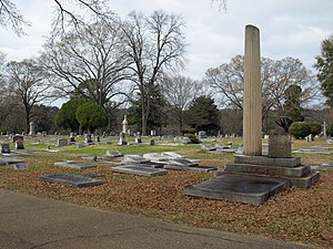
Greenwood Cemetery (Montgomery, Alabama)
Cemetery in Montgomery County, Alabama
Distance: Approx. 3896 meters
Latitude and longitude: 32.37194444,-86.26111111
Greenwood Cemetery is a cemetery in Montgomery, Alabama, United States.

Alabama Military Department
Government agency in Alabama, United States
Distance: Approx. 1709 meters
Latitude and longitude: 32.406224,-86.2639714
The Alabama Military Department is an executive department within the government of Alabama. The military department is responsible for managing the military forces of Alabama, including the Alabama Army National Guard, the Alabama Air National Guard, and the Alabama State Defense Force.

Central Alabama VA Medical Center–Montgomery
Hospital in Montgomery, Alabama
Distance: Approx. 3006 meters
Latitude and longitude: 32.3775,-86.24611111
The Central Alabama VA Medical Center–Montgomery is a medical facility of the United States Department of Veterans Affairs (VA) in Montgomery, Alabama. The hospital was built in 1940 and originally consisted of 138 acres (56 ha), but has been reduced to approximately 50 acres (20 ha). The main building is a four-story H-shape building with elements of Colonial Revival and Classical Revival styles.
Weather in this IP's area
clear sky
29 Celsius
29 Celsius
28 Celsius
30 Celsius
1012 hPa
49 %
10000 meters
4.12 m/s
140 degree
16:00:00
15:00:00
The latest IP detection test
- 232.140.105.190
- 184.78.174.151
- 215.192.219.51
- 37.60.133.65
- 149.9.182.155
- 149.73.63.57
- 165.228.226.57
- 66.208.36.18
- 11.84.82.118
- 125.174.159.82