Country:
 Japan
JapanRegion:
City:
Latitude and Longitude:
Postal Code:
Time Zone:
language:
User-Agent:
Proxy IP:
Blacklist:
IP information under different IP Channel
ip-api
Country
IPinfo
Country
MaxMind
Country
Luminati
153.228.214.230Country
JPRegion
11
City
nishihara
ASN
Time Zone
Asia/Tokyo
ISP
NTT Communications Corporation
Latitude
Longitude
Postal
db-ip
Country
ipdata
Country
Popular places and events near this IP address
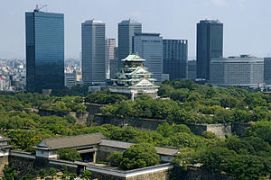
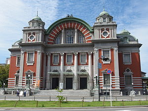
Osaka
Designated city in Kansai, Japan
Distance: Approx. 35 meters
Latitude and longitude: 34.69388889,135.50222222
Osaka (Japanese: 大阪市, Hepburn: Ōsaka-shi, pronounced [oːsakaɕi]; commonly just 大阪, Ōsaka [oːsaka] ) is a designated city in the Kansai region of Honshu in Japan, and one of the three major cities of Japan (Tokyo-Osaka-Nagoya). It is the capital of and most populous city in Osaka Prefecture, and the third-most populous city in Japan, following the special wards of Tokyo and Yokohama. With a population of 2.7 million in the 2020 census, it is also the largest component of the Keihanshin Metropolitan Area, which is the second-largest metropolitan area in Japan and the 10th-largest urban area in the world with more than 19 million inhabitants.
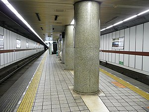
Yodoyabashi Station
Railway and metro station in Osaka, Japan
Distance: Approx. 236 meters
Latitude and longitude: 34.692317,135.501004
Yodoyabashi Station (淀屋橋駅, Yodoyabashi-eki) is a railway station on the Osaka Metro Midosuji Line and the Keihan Railway Keihan Main Line in Japan. It is the nearest station to the Osaka City Hall (大阪市役所).
Kitahama Station (Osaka)
Railway and metro station in Osaka, Japan
Distance: Approx. 499 meters
Latitude and longitude: 34.69159,135.506637
Kitahama Station (北浜駅, Kitahama-eki) is a railway station on the Keihan Electric Railway Keihan Main Line and the Osaka Metro Sakaisuji Line in Chūō-ku, Osaka, Japan. Kitahama is the closest station to the Osaka Securities Exchange and the financial district.
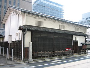
Tekijuku
Defunct higher education institute in Osaka, Japan
Distance: Approx. 342 meters
Latitude and longitude: 34.69125,135.50325
Tekijuku (適塾) was a private school (Japanese: ja:私塾, Hepburn: shijuku) of Dutch studies (Rangaku) in Osaka, Japan. Ogata Kōan, a doctor and scholar of Rangaku, established it in 1838 during the Tenpō era of the late Edo period. Its official name was Tekitekisaijuku (適々斎塾), named after one of Ogata's art names, Tekitekisai (適々斎).

Osaka Prefectural Nakanoshima Library
Distance: Approx. 110 meters
Latitude and longitude: 34.69366,135.5032
Osaka Prefectural Nakanoshima Library (大阪府立中之島図書館, Ōsaka Furitsu Nakanoshima Toshokan) is a major library in the Nakanoshima section of Osaka, Osaka Prefecture, Japan. It was established in 1904 and is today one of two libraries which are supported by the Osaka Prefectural government.

Dōjima Rice Exchange
Center of Japan's rice brokers during the Edo period located in Osaka, Japan
Distance: Approx. 342 meters
Latitude and longitude: 34.6952,135.49867
The Dōjima Rice Exchange (堂島米市場, Dōjima kome ichiba, 堂島米会所, Dōjima kome kaisho), located in Osaka, was the center of Japan's system of rice brokers, which developed independently and privately in the Edo period and would be seen as the forerunners to a modern banking system. It was first established in 1697, officially sanctioned, sponsored and organized by the shogunate in 1773, reorganized in 1868, and dissolved entirely in 1939, being absorbed into the Government Rice Agency (日本米穀株式会社)(cf.ja:食糧管理制度). The Japanese economy grew rapidly throughout the 17th century, culminating in the period known as Genroku (1688–1704) during which merchants prospered like never before.
Nakanoshima Park
Public park in Osaka, Japan
Distance: Approx. 408 meters
Latitude and longitude: 34.693056,135.506431
The Nakanoshima Park (中之島公園, Nakanoshima kōen) is the first public park opened by Osaka in 1891, after its foundation as a city. It is located in Kita ward, on the Nakanoshima sandbank, lying between Dōjima and Tosabori Rivers. The 11 hectare park houses public facilities such as Osaka Central Public Hall (built in 1918), Osaka Prefectural Nakanoshima Library and Museum of Oriental Ceramics.

Nakanoshima
Narrow sandbank in Kita-ku, Osaka, Japan
Distance: Approx. 511 meters
Latitude and longitude: 34.69361111,135.49666667
Nakanoshima (中之島) is a 3 km long and 50 hectares narrow sandbank in Kita-ku, Osaka city, Japan, that divides the Kyū-Yodo into the Tosabori and Dōjima rivers. Many governmental and commercial offices (including the city hall of Osaka), museums and other cultural facilities are located on Nakanoshima.

Ōebashi Station
Railway station in Osaka, Japan
Distance: Approx. 205 meters
Latitude and longitude: 34.694357,135.499964
Ōebashi Station (大江橋駅, Ōebashi-eki) is a railway station on the Keihan Electric Railway Nakanoshima Line in Kita-ku, Osaka, Japan, and opened on October 19, 2008 (the day of the opening of the Nakanoshima Line).

Naniwabashi Station
Railway station in Osaka, Japan
Distance: Approx. 368 meters
Latitude and longitude: 34.692972,135.505937
Naniwabashi Station (なにわ橋駅) is a railway station on the Keihan Nakanoshima Line in Kita-ku, Osaka, Japan. It opened on October 19, 2008 (the day of the opening of the Nakanoshima Line).
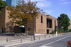
Museum of Oriental Ceramics, Osaka
Art museum in Osaka, Japan
Distance: Approx. 311 meters
Latitude and longitude: 34.693444,135.505472
The Museum of Oriental Ceramics, Osaka (大阪市立東洋陶磁美術館) is a Japanese art museum and regarded as one of the best ceramic-collections in the world. This museum collects, studies, conserves, exhibits and interprets East Asian ceramics, which mainly came from ancient China and Korea. The world-famous Ataka Collection, donated by the 21 companies of the Sumitomo Group, as well as the Rhee Byung-Chang Collection, provide the public an aesthetic experience with first-class collection.

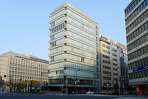
Consulate General of the United States, Osaka
Distance: Approx. 294 meters
Latitude and longitude: 34.69683333,135.50191667
The Consulate-General of the United States in Osaka-Kobe (Japanese: 駐大阪・神戸米国総領事館), commonly referred to as the U.S. Consulate-General in Osaka, is a consular post of the United States in Osaka City, Osaka Prefecture, Japan. The inclusion of "Kobe" in the name stems from its previous location in Kobe City, Hyogo Prefecture. The consulate has a public relations division known as the Kansai American Center.
Weather in this IP's area
overcast clouds
21 Celsius
20 Celsius
19 Celsius
22 Celsius
1015 hPa
48 %
10000 meters
0.51 m/s
160 degree
100 %
11:00:00
00:00:00
The latest IP detection test
- 231.71.102.193
- 81.50.83.120
- 146.7.129.85
- 135.202.247.119
- 56.128.88.177
- 38.62.164.60
- 183.245.201.184
- 253.112.212.117
- 61.96.194.209
- 64.24.10.115