Country:
 Kenya
KenyaRegion:
City:
Latitude and Longitude:
Postal Code:
Time Zone:
language:
User-Agent:
Proxy IP:
Blacklist:
IP information under different IP Channel
ip-api
Country
IPinfo
Country
MaxMind
Country
Luminati
41.90.32.77Country
KERegion
30
City
nairobi
ASN
Time Zone
Africa/Nairobi
ISP
SAFARICOM-LIMITED
Latitude
Longitude
Postal
db-ip
Country
ipdata
Country
Popular places and events near this IP address

Alliance High School (Kenya)
Public national high school in Kenya
Distance: Approx. 1782 meters
Latitude and longitude: -1.26138889,36.66638889
The Alliance High School (or AHS) popularly known among students as "Bush", is a public national high school for boys located in Kikuyu, Kenya. Established on 1 March 1926 by the Alliance of Protestant Churches - The Church of Scotland Mission (later known as the Presbyterian Church of East Africa or PCEA), Church of the Province of Kenya (CPK) (later known as the Anglican Church of Kenya), African Inland Church (AIC), the Friends Church (Quakers) and the Methodist Church the school was later named The Alliance High School from the coming together of the churches to form a school to educate African natives beyond the education standard that was offered at the time, the school was one of the first schools in Kenya to offer secondary school education to Africans. The school is located approximately 22 kilometres (14 mi) from Nairobi's central business district.
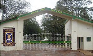
Alliance Girls High School
Public national boarding school in Kenya
Distance: Approx. 2294 meters
Latitude and longitude: -1.2663,36.6627
Alliance Girls' High School (AGHS) is a public national boarding school for girls located near the small town of Kikuyu in Kiambu County, 20 km from Nairobi. Founded in 1948 as the African Girls' High School, it is within walking distance from its brother school Alliance High School.
Gichoto
Place in Central Province, Kenya
Distance: Approx. 4091 meters
Latitude and longitude: -1.28,36.65
Gichoto is a settlement in Kenya's Central Province.
Gicharani
Place in Central Province, Kenya
Distance: Approx. 3078 meters
Latitude and longitude: -1.27,36.65
Gicharani is a settlement in Kenya's Central Province.
Gatiabai
Place in Central Province, Kenya
Distance: Approx. 1905 meters
Latitude and longitude: -1.23,36.67
Gatiabai is a settlement in Kenya's Central Province.
Gathithina
Place in Central Province, Kenya
Distance: Approx. 3418 meters
Latitude and longitude: -1.22,36.68
Githithima is a settlement in Kenya's Central Province.
Gichongo
Place in Central Province, Kenya
Distance: Approx. 3288 meters
Latitude and longitude: -1.27,36.68
Gichongo is a settlement in Kenya's Central Province.
Kamuguga
Place in Central Province, Kenya
Distance: Approx. 2959 meters
Latitude and longitude: -1.22,36.67
Kamuguga is a settlement in Kenya's Central Province.
Kahuho
Place in Central Province, Kenya
Distance: Approx. 3418 meters
Latitude and longitude: -1.22,36.68
Kahuho is a settlement in Kenya's Central Province.
Nderi
Place in Central Province, Kenya
Distance: Approx. 3216 meters
Latitude and longitude: -1.22,36.65
Nderi is a settlement in Kenya's Central Province.
Ngure
Place in Central Province, Kenya
Distance: Approx. 2559 meters
Latitude and longitude: -1.23,36.68
Ngure is a settlement in Kenya's Central Province.
Nairobi Western Bypass Highway
Kenyan road
Distance: Approx. 1893 meters
Latitude and longitude: -1.23111111,36.67194444
Nairobi Western Bypass Highway is a road in Kenya. It connects the town of Kikuyu to the town of Ruaka, both in Kiambu County.
Weather in this IP's area
light rain
15 Celsius
15 Celsius
15 Celsius
15 Celsius
1017 hPa
87 %
1017 hPa
803 hPa
10000 meters
1.02 m/s
1.39 m/s
18 degree
100 %
03:00:00
05:00:00
The latest IP detection test
- 189.205.172.238
- 58.72.26.76
- 72.43.171.57
- 89.2.153.122
- 8.88.211.68
- 28.254.158.170
- 220.60.46.80
- 62.83.221.88
- 217.36.55.196
- 112.114.184.181