Country:
 USA
USARegion:
City:
Latitude and Longitude:
Postal Code:
Time Zone:
language:
User-Agent:
Proxy IP:
Blacklist:
IP information under different IP Channel
ip-api
Country
IPinfo
Country
MaxMind
Country
Luminati
67.187.200.6Country
USRegion
ca
City
stockton
ASN
Time Zone
America/Los_Angeles
ISP
COMCAST-7922
Latitude
Longitude
Postal
db-ip
Country
ipdata
Country
Popular places and events near this IP address

East Oakdale, California
Census-designated place in California, United States
Distance: Approx. 4665 meters
Latitude and longitude: 37.79361111,-120.80666667
East Oakdale is an unincorporated census-designated place (CDP) on the Stanislaus River, located east of the city of Oakdale in Stanislaus County, California. It is part of the Modesto Metropolitan Statistical Area in the San Joaquin Valley. The population was 2,762 at the 2010 census.

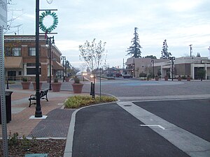
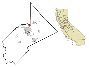
Oakdale, California
City in California, United States
Distance: Approx. 904 meters
Latitude and longitude: 37.76916667,-120.85694444
Oakdale is a city in the San Joaquin Valley and Stanislaus County, California. It is part of the Modesto Metropolitan Statistical Area. Oakdale goes by the slogan "Cowboy Capital of the World." The population was 23,181 at the 2020 census, up from 20,675 at the 2010 census and 15,503 at the 2000 census.
Riverbank, California
City in California, United States
Distance: Approx. 9348 meters
Latitude and longitude: 37.73138889,-120.94361111
Riverbank is a city in Stanislaus County, California, United States. The population was 24,623 at the 2020 census, up from 15,826 at the 2000 census. Incorporated on August 23, 1922, Riverbank's official slogan is "City of Action." It is part of the Modesto Metropolitan Statistical Area.
Oakdale High School (California)
Public school in Oakdale, California, United States
Distance: Approx. 881 meters
Latitude and longitude: 37.76139444,-120.85473889
Oakdale High School is a high school located in the Oakdale Joint Unified School District in Oakdale, California, United States. The mascot is the Mustang. The school serves students in grades nine through twelve.
Oakdale Airport
Airport in Oakdale, California
Distance: Approx. 4283 meters
Latitude and longitude: 37.75638889,-120.80027778
Oakdale Airport (IATA: ODC, FAA LID: O27) is a public airport located three miles (4.8 km) southeast of the central business district (CBD) of Oakdale, a city in Stanislaus County, California, USA. The airport covers 117 acres (47 ha) and has one runway. It is mostly used for general aviation.
Riverbank Army Ammunition Plant
Distance: Approx. 8033 meters
Latitude and longitude: 37.71805556,-120.91472222
Riverbank Army Ammunition Plant is located just outside Riverbank, California, in Stanislaus County. The facility was built in 1942 as an aluminum reduction plant operated by Alcoa producing 48,000 tons per year for World War II aircraft manufacture until 1944. It was reactivated in 1951 for the Korean War and was the United States' largest producer of steel cartridge cases until 1958.
KCBC
Radio station in Manteca, California
Distance: Approx. 4700 meters
Latitude and longitude: 37.7975,-120.88361111
KCBC (770 kHz) is a commercial AM radio station broadcasting a Christian talk and teaching radio format. It is Licensed to Manteca, California, with radio studios and offices in Oakdale. The station is owned by the Crawford Broadcasting Company with the license held by subsidiary Kiertron, Inc.
Riverbank High School
High school in California, United States
Distance: Approx. 7607 meters
Latitude and longitude: 37.7313,-120.9212
Riverbank High School is located at 6200 Claus Road in Riverbank, California, and is one of the two high schools in the Riverbank Unified School District along with Adelante High School, an alternative education school.
Rancho Thompson
Mexican land grant
Distance: Approx. 5292 meters
Latitude and longitude: 37.8,-120.89
Rancho Thompson (also called "Eight Leagues on Stanislaus River") was a 35,533-acre (143.80 km2) Mexican land grant in present-day San Joaquin County and Stanislaus County, California given in 1846 by Governor Pío Pico to Alpheus Basil Thompson. The rectangular grant was 2 leagues (6.0 miles; 9.7 kilometres) along both sides of the Stanislaus River by 4 leagues (12 miles; 19 kilometres) – mostly north of the river. The grant encompassed present-day Riverbank and Oakdale.
Langworth, California
Unincorporated community in California, United States
Distance: Approx. 4682 meters
Latitude and longitude: 37.7536,-120.8978
Langworth is a small unincorporated community in Stanislaus County, California, United States and is 3 miles west of Oakdale, California.
Valley Home, California
Census-designated place in California, United States
Distance: Approx. 9069 meters
Latitude and longitude: 37.82777778,-120.91527778
Valley Home is a census-designated place (CDP) in Stanislaus County, California. It is located about 8 miles (13 km) northwest of Oakdale, and named after the warm home feeling for the Central Valley. Valley Home sits at an elevation of 151 feet (46 m).
Weather in this IP's area
clear sky
25 Celsius
24 Celsius
24 Celsius
28 Celsius
996 hPa
38 %
10000 meters
5.66 m/s
9.77 m/s
320 degree
16:00:00
01:00:00
The latest IP detection test
- 110.191.21.117
- 60.159.206.143
- 252.68.214.182
- 13.30.131.215
- 171.129.49.229
- 6.12.21.158
- 27.233.55.202
- 137.141.235.129
- 36.194.141.252
- 133.106.143.98