Country:
Region:
City:
Latitude and Longitude:
Postal Code:
Time Zone:
language:
User-Agent:
Proxy IP:
Blacklist:
IP information under different IP Channel
Luminati
81.108.157.62Country
Region
eng
City
birtley
ASN
Time Zone
Europe/London
ISP
Virgin Media
Latitude
Longitude
Postal
Popular places and events near this IP address

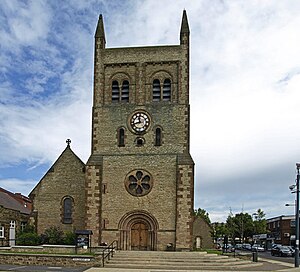
Consett
Town in County Durham, England
Distance: Approx. 1949 meters
Latitude and longitude: 54.85,-1.83
Consett is a town in the County Durham district, in the ceremonial county of Durham, England, about 14 miles (23 km) south-west of Newcastle upon Tyne. It had a population of 27,394 in 2001 and an estimate of 25,812 in 2019.

Knitsley
Human settlement in England
Distance: Approx. 809 meters
Latitude and longitude: 54.83333333,-1.81666667
Knitsley is a hamlet in and former civil parish, now in the parish of Healeyfield, in the County Durham district, in the ceremonial county of Durham, England. It is situated a short distance to the south of the town of Consett. In 1931 the parish had a population of 2276.
Crookhall
Human settlement in England
Distance: Approx. 1894 meters
Latitude and longitude: 54.849,-1.822
Crookhall is a village in County Durham, in England. It is situated between Consett and Delves Lane. It is named after, and intimately connected to, Crook Hall which once stood nearby.
Consett A.F.C.
Association football club in England
Distance: Approx. 2010 meters
Latitude and longitude: 54.850281,-1.8237868
Consett Association Football Club is a football club based in Consett in County Durham, England. They are currently members of the Northern Premier League Division One East and play at Belle View Stadium.
Derwentside College
Further education school in Consett, County Durham, England
Distance: Approx. 2006 meters
Latitude and longitude: 54.8501,-1.8359
Derwentside College is a further education college based in Consett, County Durham, England. It is the major provider of vocational post-16 education and training in the former district of Derwentside. The Principal and Chief Executive is Chris Todd, who took over from Karen Redhead in 2019.

Delves Lane
Human settlement in England
Distance: Approx. 1502 meters
Latitude and longitude: 54.841,-1.811
Delves Lane is a small village to the south of Consett, County Durham, England. The housing in the area was built as a suburb of Consett, historically providing housing for people working in the former mining and steel industries. The village has one pub: 'The Traveller's Rest'.
Consett Power Station
Distance: Approx. 2332 meters
Latitude and longitude: 54.850109,-1.848898
Consett Power Station refers to numerous, now demolished coal-fired power stations situated on various sites around Consett in County Durham, North East England.
Crook Hall
Distance: Approx. 2428 meters
Latitude and longitude: 54.8512,-1.8097
Crook Hall, sited near Lanchester, County Durham, some 8 miles (13 km) north west of the city of Durham, was the seat of the Baker family and one of two Roman Catholic seminaries which temporarily replaced the Douai seminary in Douai, France when that college was suppressed soon after the French Revolution. Crook Hall was itself superseded after a few years by Ushaw College.

Hownsgill Viaduct
Distance: Approx. 1535 meters
Latitude and longitude: 54.8356,-1.85252778
The Hownsgill Viaduct (in some sources called Hownes Gill Viaduct and locally called the Gill bridge) is a former railway bridge located west of Consett in County Durham, England. It is currently used as a footpath and cycleway.

Consett railway station
Former railway station in England
Distance: Approx. 2063 meters
Latitude and longitude: 54.851,-1.8273
Consett was a railway station built by the North Eastern Railway on the route of the Stanhope and Tyne Railway, in County Durham, North East England. It served the industrial town of Consett, which was best known for its steelworks.

Rowley railway station (England)
Disused railway station in Rowley and Castleside, County Durham
Distance: Approx. 2471 meters
Latitude and longitude: 54.8259,-1.866
Rowley railway station served the hamlet of Rowley and the village of Castleside in County Durham, England from 1845 to 1966 on the Derwent Railway.
Knitsley railway station
Disused railway station in Knitsley, County Durham
Distance: Approx. 1073 meters
Latitude and longitude: 54.8331,-1.8125
Knitsley railway station served the hamlet of Knitsley, County Durham, England from 1862 to 1939 on the Lanchester Valley Railway.
Weather in this IP's area
overcast clouds
14 Celsius
13 Celsius
12 Celsius
17 Celsius
1020 hPa
72 %
1020 hPa
998 hPa
10000 meters
4.29 m/s
8.2 m/s
142 degree
100 %
22:00:00
01:00:00