Country:
 Great Britain
Region:
City:
Latitude and Longitude:
Postal Code:
Time Zone:
language:
User-Agent:
Proxy IP:
Blacklist:
IP information under different IP Channel
ip-api
Country
IPinfo
Country
MaxMind
Country
Luminati
91.207.37.55Country
GBASN
Time Zone
Europe/London
ISP
VeriFone Systems France SAS
Latitude
Longitude
Postal
db-ip
Country
ipdata
Country
Popular places and events near this IP address

Lenham railway station
Railway station in Kent, England
Distance: Approx. 3426 meters
Latitude and longitude: 51.234,0.708
Lenham railway station serves Lenham in Kent, England. It is 49 miles 11 chains (79.1 km) down the line from London Victoria. The station, and all trains serving it, is operated by Southeastern.
Faversham and Mid Kent (UK Parliament constituency)
Distance: Approx. 3484 meters
Latitude and longitude: 51.25,0.8
Faversham and Mid Kent is a constituency represented in the House of Commons of the UK Parliament. Since 2015, the seat has been held by Helen Whately of the Conservative Party.
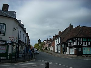
Lenham
Human settlement in England
Distance: Approx. 2720 meters
Latitude and longitude: 51.238,0.716
Lenham is a market village and civil parish in Kent situated on the southern edge of the North Downs, 9 miles (14 km) east of Maidstone. The picturesque square in the village has two public houses (one of which is a hotel), a couple of restaurants, and a tea-room. Lenham has a population of 3,370 according to the 2011 Census.
Otterden
Human settlement in England
Distance: Approx. 2842 meters
Latitude and longitude: 51.245,0.79
Otterden is a civil parish and village on the Kent Downs in the borough of Maidstone in Kent, England.
Wichling
Human settlement in England
Distance: Approx. 2034 meters
Latitude and longitude: 51.268,0.745
Wichling (otherwise Wychling) is a village and civil parish within the local government district of Maidstone, in England. The parish lies approximately 10 miles (16 km) to the east of Maidstone. It lies near the top of the ridge of the North Downs and consists mainly of isolated farms and houses: the population is therefore small in number.
The Lenham School
Academy in Lenham, Kent, England
Distance: Approx. 3022 meters
Latitude and longitude: 51.2384,0.7108
The Lenham School is a coeducational secondary school and sixth form located in Lenham, Kent, England. It opened in 1952, as Swadelands School, and provides a secondary education for 788 boys and girls aged 11 to 18 years. Ofsted published a report in 2010 which detailed their findings as satisfactory, with a proven ability to attain a rating of good with continued improvement.
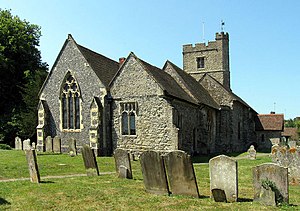
Bunce Court School
Boarding school in Otterden, Kent, England
Distance: Approx. 1926 meters
Latitude and longitude: 51.24643,0.77704
The Bunce Court School was an independent, private boarding school in the village of Otterden, in Kent, England. It was founded in 1933 by Anna Essinger, who had previously founded a boarding school, Landschulheim Herrlingen in the south of Germany, but after the Nazi Party seized power in 1933, she began to see that the school had no future in Germany. She quietly found a new home for the school and received permission from the parents of her pupils, most of whom were Jewish, to bring them to safety in England.
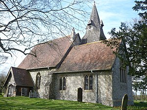
St Mary's Church, Lenham
Church in Kent, England
Distance: Approx. 2609 meters
Latitude and longitude: 51.236711,0.719165
St Mary's is a parish church in Lenham, Kent, England, begun in the 12th century with additions in the next three centuries. It is a Grade I listed building.
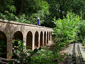
Torry Hill Railway
Miniature railway in Kent, England
Distance: Approx. 3128 meters
Latitude and longitude: 51.277665,0.742133
The Torry Hill Railway is a private miniature railway with the unusual gauge of 9 inches (229 mm) at Torry Hill near Frinsted in the Borough of Maidstone in Kent, England. It operates only occasionally.
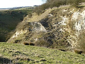
Hart Hill, Kent
Distance: Approx. 3753 meters
Latitude and longitude: 51.222,0.78
Hart Hill is a 1.4-hectare (3.5-acre) geological Site of Special Scientific Interest north-west of Charing Kent. It is a Geological Conservation Review site. This site is controversial as it exposes the Lenham Beds, the date of which has been disputed, but they are now thought to be Pliocene, on the basis of their marine bivalves and gastropods.
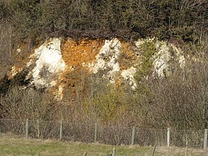
Lenham Quarry
Site of Special Scientific Interest in Kent, England
Distance: Approx. 1278 meters
Latitude and longitude: 51.24,0.741
Lenham Quarry is a 4-hectare (9.9-acre) geological Site of Special Scientific Interest east of Lenham in Kent. It is a Geological Conservation Review site. This site has been assigned to the Pliocene on the basis of its gastropod, bivalve and serpulid worm fossils.
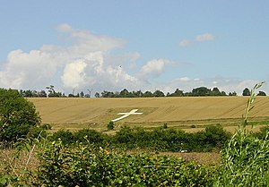
Lenham Cross
Distance: Approx. 1684 meters
Latitude and longitude: 51.2424,0.7291
The Lenham Cross is a chalk cross carved into the hillside to the north of Lenham in Kent, in England. The Latin cross is 200 ft (61 m) high with arms 70 ft (21 m) wide. It was designed by Mr C H Groom, the headmaster of the village school, as a First World War memorial.
Weather in this IP's area
broken clouds
16 Celsius
16 Celsius
13 Celsius
19 Celsius
1013 hPa
64 %
1013 hPa
992 hPa
10000 meters
5.88 m/s
7.73 m/s
37 degree
62 %
15:00:00
04:00:00
The latest IP detection test
- 249.65.208.47
- 131.202.167.65
- 244.169.90.117
- 41.182.127.107
- 56.129.90.180
- 94.96.3.80
- 81.18.65.186
- 244.111.67.10
- 166.141.4.186
- 219.62.165.154