Country:
 USA
USARegion:
City:
Latitude and Longitude:
Postal Code:
Time Zone:
language:
User-Agent:
Proxy IP:
Blacklist:
IP information under different IP Channel
Luminati
204.1.95.13Country
USASN
Time Zone
America/Chicago
ISP
NTT-LTD-2914
Latitude
Longitude
Postal
Popular places and events near this IP address

Redmond, Washington
City in Washington, United States
Distance: Approx. 1515 meters
Latitude and longitude: 47.66944444,-122.12388889
Redmond is a city in King County, Washington, United States, located 15 miles (24 km) east of Seattle. The population was 73,256 at the 2020 census. Redmond is best known as the home of Microsoft and Nintendo of America.
DigiPen Institute of Technology
University in the United States
Distance: Approx. 2320 meters
Latitude and longitude: 47.68888889,-122.15055556
DigiPen Institute of Technology is a private for-profit university in Redmond, Washington. It also has campuses in Singapore and Bilbao, Spain. DigiPen offers bachelor's and master's degree programs.
Overlake Christian Church
Distance: Approx. 1589 meters
Latitude and longitude: 47.6891,-122.14
Overlake Christian Church is a non-denominational megachurch in Redmond, Washington.
PSE Trail
Distance: Approx. 1290 meters
Latitude and longitude: 47.68833333,-122.13611111
The PSE Trail, also called the Puget Power Trail and the Redmond Powerline Trail, is an unpaved equestrian, pedestrian and mountain bike trail in Redmond, Washington. It links the Redmond Central Connector and Sammamish River Trail to Farrel-McWhirter Park. The trail begins at the Redmond Central Connector.
Redmond High School (Washington)
Public school in Redmond, Washington, United States
Distance: Approx. 1742 meters
Latitude and longitude: 47.69527778,-122.10666667
Redmond High School (RHS) is a four-year public high school located in Redmond, Washington, United States. It is one of four high schools in the Lake Washington School District (LWSD). Opened in 1964, Redmond High School is the second oldest high school in the Lake Washington School District.
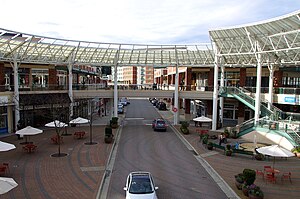
Redmond Town Center
Shopping mall in Washington, US
Distance: Approx. 1406 meters
Latitude and longitude: 47.67027778,-122.12027778
Redmond Town Center is a mixed-use development and shopping center located in downtown Redmond, Washington. Owned and managed by Fairbourne Properties, Redmond Town Center has more than 110 shops, restaurants, lodging, and entertainment venues in an outdoor environment. It opened in 1997 on the site of a defunct municipal golf course along the north side of State Route 520.

Downtown Redmond station
Future light rail station in Redmond, Washington
Distance: Approx. 1188 meters
Latitude and longitude: 47.67224,-122.120156
Downtown Redmond station is a future Link light rail station on the north side of Redmond Town Center shopping mall in downtown Redmond, Washington. It will be elevated located along Cleveland Street (SR 202) between 164th and 166th avenues. The station was originally included in the Sound Transit 2 ballot measure in 2008, but was left out of the East Link Extension after a funding shortfall stemming from the City of Bellevue's desire for a tunneled alignment under Downtown Bellevue.

Hopelink
American nonprofit agency
Distance: Approx. 1016 meters
Latitude and longitude: 47.68175,-122.13435
Hopelink is a social services nonprofit agency based in Redmond, Washington. The Interim CEO is Geoff Crump. It serves north and east King County, Washington, with food banks, energy assistance, housing, a family development program, transportation and adult education.

Anderson Park (Redmond, Washington)
United States historic place
Distance: Approx. 1169 meters
Latitude and longitude: 47.673,-122.1157
Anderson Park is a public park in the city of Redmond, Washington. The site was acquired in 1928 as Redmond City Park before being expanded and improved through the economic response of the Federal Works Progress Administration in 1938. The park was given its present name in 1946, and is listed on the National Register of Historic Places.

Jerry Baker Memorial Velodrome
Distance: Approx. 2019 meters
Latitude and longitude: 47.665759,-122.112079
The Jerry Baker Memorial Velodrome is a 1,300-foot (400 m) outdoor bicycle racing track located in Redmond, Washington. It was built in 1974 and was resurfaced in 2005. The current track racing surface is 400 meters in total length, with a maximum slope of 23 degrees in the corners.

Marymoor Village station
Future light rail station in Redmond, Washington
Distance: Approx. 1936 meters
Latitude and longitude: 47.6674,-122.1092
Marymoor Village station is a future Link light rail station near Marymoor Park in Redmond, Washington. The station is located along the south side of State Route 520 southwest of its interchange with State Route 202 near Downtown Redmond. It also includes a 1,400-stall park and ride in a garage built on the site.

Bear Creek (Washington)
River
Distance: Approx. 1703 meters
Latitude and longitude: 47.66805556,-122.12638889
Bear Creek is a tributary of the Sammamish River in King County, Washington, United States. The stream flows approximately 12.4 miles (20.0 km) from its source at Paradise Lake near Maltby to a confluence with the Sammamish River at Marymoor Park in Redmond. The creek has two tributaries, Cottage Lake Creek and Evans Creek, and a watershed of 32,100 acres (13,000 ha).
Weather in this IP's area
clear sky
23 Celsius
23 Celsius
20 Celsius
26 Celsius
1020 hPa
45 %
10000 meters
0.89 m/s
1.34 m/s
280 degree
5 %
01:00:00
19:00:00